This weather event on August 30, 2025 includes:
4 states
32 counties,
6 cities,
and 64 zip codes.
There were 29 total properties that were impacted and have possible damage.
States Impacted By Hail On August 30, 2025
Colorado
·
Kansas
·
Nebraska
·
South Dakota
Counties Impacted By Hail On August 30, 2025
Phillips, CO
·
Rawlins, KS
·
Arthur, NE
·
Box Butte, NE
·
Brown, NE
·
Chase, NE
·
Cherry, NE
·
Custer, NE
·
Dawes, NE
·
Dawson, NE
·
Deuel, NE
·
Dundy, NE
·
Frontier, NE
·
Garden, NE
·
Garfield, NE
·
Grant, NE
·
Hayes, NE
·
Hitchcock, NE
·
Holt, NE
·
Keith, NE
·
Keya Paha, NE
·
Lincoln, NE
·
Loup, NE
·
Morrill, NE
·
Perkins, NE
·
Red Willow, NE
·
Sheridan, NE
·
Valley, NE
·
Bennett, SD
·
Gregory, SD
·
Jackson, SD
·
Tripp, SD
Cities Impacted By Hail On August 30, 2025
Broadwater, NE
·
Enders, NE
·
Farnam, NE
·
Hyannis, NE
·
Maxwell, NE
·
Sutherland, NE
Zip Codes Impacted By Hail On August 30, 2025
57529
·
57533
·
57543
·
57547
·
57551
·
57574
·
57577
·
67730
·
67745
·
68713
·
68753
·
68813
·
68822
·
68823
·
68828
·
68837
·
68856
·
68862
·
68874
·
68879
·
69001
·
69021
·
69022
·
69023
·
69024
·
69027
·
69028
·
69029
·
69030
·
69033
·
69038
·
69040
·
69041
·
69043
·
69045
·
69101
·
69121
·
69122
·
69125
·
69132
·
69134
·
69140
·
69143
·
69144
·
69146
·
69148
·
69150
·
69151
·
69153
·
69155
·
69165
·
69168
·
69218
·
69333
·
69339
·
69340
·
69343
·
69348
·
69350
·
69366
·
80721
·
80734
·
69147
·
69210
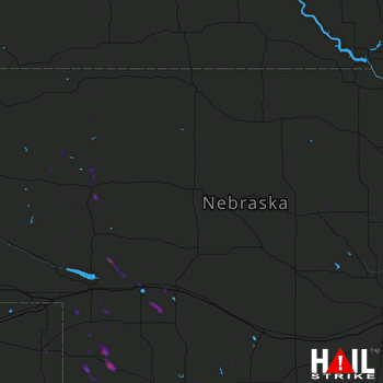 NORTH PLATTE (KLNX) RADAR

