This weather event on August 29, 2025 includes:
4 states
27 counties,
15 cities,
and 76 zip codes.
There were 211 total properties that were impacted and have possible damage.
States Impacted By Hail On August 29, 2025
Iowa
·
Illinois
·
Minnesota
·
Wisconsin
Counties Impacted By Hail On August 29, 2025
Allamakee, IA
·
Benton, IA
·
Bremer, IA
·
Chickasaw, IA
·
Clayton, IA
·
Clinton, IA
·
Delaware, IA
·
Dubuque, IA
·
Fayette, IA
·
Jackson, IA
·
Jones, IA
·
Linn, IA
·
Winneshiek, IA
·
Carroll, IL
·
Jo Daviess, IL
·
Stephenson, IL
·
Dodge, MN
·
Fillmore, MN
·
Freeborn, MN
·
Goodhue, MN
·
Houston, MN
·
Le Sueur, MN
·
Olmsted, MN
·
Rice, MN
·
Steele, MN
·
Grant, WI
·
Lafayette, WI
Cities Impacted By Hail On August 29, 2025
Apple River, IL
·
Baldwin, IA
·
Benton, WI
·
Bernard, IA
·
Clayton, IA
·
Dickeyville, WI
·
Jackson Junction, IA
·
Monmouth, IA
·
Oelwein, IA
·
Randalia, IA
·
Rickardsville, IA
·
Rochester, MN
·
Stockton, IL
·
The Galena Territory, IL
·
Warren, IL
Zip Codes Impacted By Hail On August 29, 2025
50630
·
50655
·
50662
·
50674
·
50681
·
52032
·
52033
·
52037
·
52039
·
52041
·
52049
·
52052
·
52053
·
52060
·
52073
·
52078
·
52079
·
52144
·
52162
·
52164
·
52171
·
52172
·
52175
·
52205
·
52207
·
52212
·
52214
·
52223
·
52237
·
52254
·
52309
·
52310
·
52315
·
52321
·
52362
·
53530
·
53541
·
53586
·
53803
·
53807
·
53808
·
53811
·
53818
·
53820
·
55046
·
55049
·
55060
·
55088
·
55902
·
55904
·
55912
·
55917
·
55922
·
55923
·
55943
·
55946
·
55949
·
55954
·
55962
·
55971
·
55976
·
55985
·
56069
·
56071
·
61001
·
61028
·
61036
·
61041
·
61053
·
61062
·
61085
·
61087
·
52147
·
52218
·
52346
·
61075
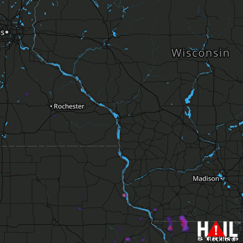 LA CROSSE (KARX) RADAR

