This weather event on August 28, 2025 includes:
3 states
29 counties,
12 cities,
and 68 zip codes.
There were 1319 total properties that were impacted and have possible damage.
States Impacted By Hail On August 28, 2025
Arkansas
·
Louisiana
·
Texas
Counties Impacted By Hail On August 28, 2025
Columbia, AR
·
Lafayette, AR
·
Miller, AR
·
Bienville, LA
·
Bossier, LA
·
Caddo, LA
·
Caldwell, LA
·
Claiborne, LA
·
Franklin, LA
·
Grant, LA
·
Jackson, LA
·
LaSalle, LA
·
Lincoln, LA
·
Natchitoches, LA
·
Ouachita, LA
·
Rapides, LA
·
Union, LA
·
Vernon, LA
·
Webster, LA
·
Bowie, TX
·
Gregg, TX
·
Harrison, TX
·
Hopkins, TX
·
Marion, TX
·
Morris, TX
·
Red River, TX
·
Rusk, TX
·
Titus, TX
·
Upshur, TX
Cities Impacted By Hail On August 28, 2025
Bossier City, LA
·
Choudrant, LA
·
Dubach, LA
·
Emerson, AR
·
Greenwood, LA
·
Haynesville, LA
·
Lisbon, LA
·
Longview, TX
·
Rock Hill, LA
·
Shreveport, LA
·
Simpson, LA
·
Vivian, LA
Zip Codes Impacted By Hail On August 28, 2025
71006
·
71029
·
71033
·
71037
·
71038
·
71039
·
71040
·
71043
·
71048
·
71051
·
71061
·
71064
·
71072
·
71129
·
75571
·
71073
·
71079
·
71082
·
71107
·
71110
·
71112
·
71119
·
71202
·
71222
·
71225
·
71227
·
71235
·
71270
·
71275
·
71292
·
71295
·
71303
·
71336
·
71360
·
71409
·
71416
·
71417
·
71418
·
71427
·
71435
·
71446
·
71454
·
71455
·
71456
·
71465
·
71468
·
71474
·
71740
·
71753
·
71837
·
71839
·
71845
·
75433
·
75455
·
75482
·
75550
·
75554
·
75559
·
75574
·
75604
·
75605
·
75644
·
75657
·
75661
·
75672
·
75681
·
75686
·
75692
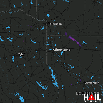 SHREVEPORT (KSHV) RADAR

