This weather event on August 24, 2025 includes:
2 states
28 counties,
5 cities,
and 65 zip codes.
There were 328 total properties that were impacted and have possible damage.
States Impacted By Hail On August 24, 2025
Kansas
·
Oklahoma
Counties Impacted By Hail On August 24, 2025
Barber, KS
·
Barton, KS
·
Comanche, KS
·
Edwards, KS
·
Finney, KS
·
Ford, KS
·
Gove, KS
·
Gray, KS
·
Haskell, KS
·
Hodgeman, KS
·
Kearny, KS
·
Kiowa, KS
·
Lane, KS
·
Logan, KS
·
Meade, KS
·
Ness, KS
·
Pawnee, KS
·
Pratt, KS
·
Rush, KS
·
Scott, KS
·
Stafford, KS
·
Thomas, KS
·
Trego, KS
·
Wallace, KS
·
Wichita, KS
·
Ellis, OK
·
Woods, OK
·
Woodward, OK
Cities Impacted By Hail On August 24, 2025
Holcomb, KS
·
Leoti, KS
·
Mullinville, KS
·
Scott City, KS
·
Seward, KS
Zip Codes Impacted By Hail On August 24, 2025
67029
·
67035
·
67054
·
67057
·
67059
·
67065
·
67071
·
67109
·
67143
·
67155
·
67511
·
67516
·
67521
·
67523
·
67529
·
67530
·
67547
·
67550
·
67556
·
67559
·
67560
·
67563
·
67567
·
67574
·
67575
·
67576
·
67672
·
67701
·
67732
·
67738
·
67743
·
67747
·
67748
·
67758
·
67761
·
67764
·
67801
·
67834
·
67837
·
67838
·
67839
·
67841
·
67842
·
67844
·
67846
·
67849
·
67850
·
67851
·
67853
·
67854
·
67860
·
67861
·
67863
·
67864
·
67867
·
67868
·
67871
·
67876
·
67877
·
73717
·
73840
·
73842
·
73843
·
73852
·
73860
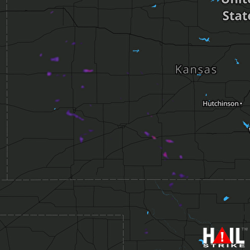 DODGE CITY (KDDC) RADAR

