This weather event on August 24, 2025 includes:
2 states
27 counties,
11 cities,
and 71 zip codes.
There were 156 total properties that were impacted and have possible damage.
States Impacted By Hail On August 24, 2025
Kansas
·
Nebraska
Counties Impacted By Hail On August 24, 2025
Decatur, KS
·
Ellis, KS
·
Gove, KS
·
Ness, KS
·
Norton, KS
·
Osborne, KS
·
Pawnee, KS
·
Phillips, KS
·
Rawlins, KS
·
Rooks, KS
·
Rush, KS
·
Sheridan, KS
·
Trego, KS
·
Buffalo, NE
·
Custer, NE
·
Dawson, NE
·
Frontier, NE
·
Gosper, NE
·
Greeley, NE
·
Hall, NE
·
Hitchcock, NE
·
Lincoln, NE
·
Logan, NE
·
McPherson, NE
·
Red Willow, NE
·
Sherman, NE
·
Valley, NE
Cities Impacted By Hail On August 24, 2025
Arnold, NE
·
Berwyn, NE
·
Broken Bow, NE
·
Dresden, KS
·
Hoxie, KS
·
North Loup, NE
·
Oconto, NE
·
Quinter, KS
·
Ransom, KS
·
Rush Center, KS
·
Stockton, KS
Zip Codes Impacted By Hail On August 24, 2025
67513
·
67515
·
67521
·
67548
·
67550
·
67556
·
67559
·
67560
·
67572
·
67574
·
67575
·
67584
·
67601
·
67629
·
67631
·
67635
·
67639
·
67643
·
67651
·
67654
·
67658
·
67663
·
67669
·
67672
·
67673
·
67730
·
67736
·
67737
·
67738
·
67739
·
67740
·
67744
·
67749
·
67751
·
67752
·
68812
·
68814
·
68822
·
68824
·
68825
·
68834
·
68850
·
68855
·
68856
·
68858
·
68859
·
68860
·
68863
·
68866
·
68869
·
68871
·
68875
·
68876
·
68878
·
68936
·
69001
·
69025
·
69028
·
69042
·
69043
·
69044
·
69101
·
69123
·
69130
·
69138
·
69151
·
69163
·
69167
·
69120
·
68976
·
67653
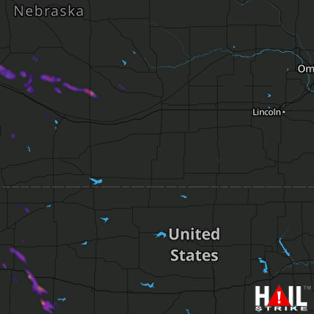 HASTINGS (KUEX) RADAR

