This weather event on August 23, 2025 includes:
3 states
23 counties,
17 cities,
and 63 zip codes.
There were 1127 total properties that were impacted and have possible damage.
States Impacted By Hail On August 23, 2025
Colorado
·
Kansas
·
Nebraska
Counties Impacted By Hail On August 23, 2025
Logan, CO
·
Phillips, CO
·
Sedgwick, CO
·
Yuma, CO
·
Cheyenne, KS
·
Decatur, KS
·
Graham, KS
·
Norton, KS
·
Sherman, KS
·
Thomas, KS
·
Chase, NE
·
Cheyenne, NE
·
Deuel, NE
·
Dundy, NE
·
Frontier, NE
·
Furnas, NE
·
Gosper, NE
·
Harlan, NE
·
Hayes, NE
·
Hitchcock, NE
·
Keith, NE
·
Perkins, NE
·
Red Willow, NE
Cities Impacted By Hail On August 23, 2025
Amherst, CO
·
Beaver City, NE
·
Chappell, NE
·
Danbury, NE
·
Haxtun, CO
·
Hayes Center, NE
·
Holbrook, NE
·
Holyoke, CO
·
Imperial, NE
·
Indianola, NE
·
Julesburg, CO
·
Lenora, KS
·
Max, NE
·
Ovid, CO
·
Palisade, NE
·
Paoli, CO
·
Trenton, NE
Zip Codes Impacted By Hail On August 23, 2025
67622
·
67625
·
67632
·
67642
·
67645
·
67653
·
67654
·
67731
·
67732
·
67733
·
67749
·
67756
·
68922
·
68926
·
68948
·
68966
·
68967
·
69001
·
69020
·
69021
·
69022
·
69023
·
69024
·
69025
·
69027
·
69029
·
69030
·
69032
·
69033
·
69034
·
69036
·
69037
·
69038
·
69040
·
69041
·
69042
·
69043
·
69044
·
69045
·
69122
·
69127
·
69129
·
69134
·
69140
·
69149
·
69150
·
69162
·
69168
·
80721
·
80726
·
80727
·
80728
·
80731
·
80734
·
80737
·
80744
·
80746
·
80749
·
80755
·
80758
·
68977
·
69026
·
80759
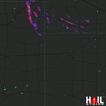 GOODLAND (KGLD) RADAR

