This weather event on August 22, 2025 includes:
2 states
26 counties,
17 cities,
and 63 zip codes.
There were 475 total properties that were impacted and have possible damage.
States Impacted By Hail On August 22, 2025
Alabama
·
Georgia
Counties Impacted By Hail On August 22, 2025
Autauga, AL
·
Baldwin, AL
·
Barbour, AL
·
Butler, AL
·
Chilton, AL
·
Clarke, AL
·
Coffee, AL
·
Conecuh, AL
·
Coosa, AL
·
Covington, AL
·
Crenshaw, AL
·
Dale, AL
·
Dallas, AL
·
Elmore, AL
·
Escambia, AL
·
Henry, AL
·
Lee, AL
·
Lowndes, AL
·
Macon, AL
·
Monroe, AL
·
Montgomery, AL
·
Pike, AL
·
Tallapoosa, AL
·
Wilcox, AL
·
Chattahoochee, GA
·
Troup, GA
Cities Impacted By Hail On August 22, 2025
Abbeville, AL
·
Ariton, AL
·
Cusseta-Chattahoochee County, GA
·
Franklin, AL
·
Greenville, AL
·
Luverne, AL
·
Notasulga, AL
·
Peterman, AL
·
Pike Road, AL
·
Pine Apple, AL
·
Pine Level, AL
·
Prattville, AL
·
Reeltown, AL
·
Tallassee, AL
·
Tuskegee, AL
·
Valley Grande, AL
·
Wetumpka, AL
Zip Codes Impacted By Hail On August 22, 2025
30230
·
31805
·
35136
·
36009
·
36017
·
36022
·
36025
·
36026
·
36028
·
36032
·
36034
·
36037
·
36039
·
36043
·
36047
·
36048
·
36049
·
36052
·
36054
·
36064
·
36066
·
36067
·
36069
·
36075
·
36078
·
36080
·
36083
·
36088
·
36091
·
36092
·
36093
·
36105
·
36110
·
36116
·
36310
·
36311
·
36323
·
36346
·
36353
·
36420
·
36421
·
36425
·
36445
·
36460
·
36471
·
36474
·
36480
·
36545
·
36550
·
36703
·
36726
·
36753
·
36761
·
36767
·
36768
·
36785
·
36850
·
36853
·
36866
·
36832
·
36701
·
36040
·
36010
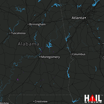 MONTGOMERY (KMXX) RADAR

