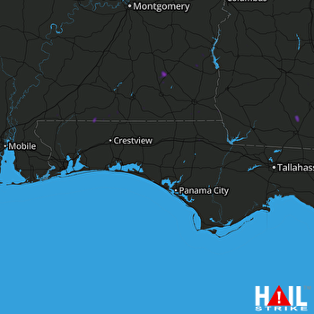
This weather event on August 21, 2025 includes:
3 states
32 counties,
10 cities,
and 67 zip codes.
There were 131 total properties that were impacted and have possible damage.
States Impacted By Hail On August 21, 2025
Alabama
·
Florida
·
Georgia
Counties Impacted By Hail On August 21, 2025
Baldwin, AL
·
Barbour, AL
·
Butler, AL
·
Coffee, AL
·
Covington, AL
·
Dale, AL
·
Escambia, AL
·
Geneva, AL
·
Henry, AL
·
Houston, AL
·
Mobile, AL
·
Monroe, AL
·
Pike, AL
·
Washington, AL
·
Bay, FL
·
Escambia, FL
·
Jackson, FL
·
Okaloosa, FL
·
Santa Rosa, FL
·
Baker, GA
·
Colquitt, GA
·
Dougherty, GA
·
Early, GA
·
Lee, GA
·
Miller, GA
·
Mitchell, GA
·
Randolph, GA
·
Seminole, GA
·
Stewart, GA
·
Thomas, GA
·
Webster, GA
·
Worth, GA
Cities Impacted By Hail On August 21, 2025
Albany, GA
·
Bakerhill, AL
·
Blakely, GA
·
Cedar Springs, GA
·
Coleman, GA
·
Cottondale, FL
·
Dothan, AL
·
Mobile, AL
·
Rehobeth, AL
·
Webster County, GA
Zip Codes Impacted By Hail On August 21, 2025
31701
·
31705
·
31730
·
31738
·
31756
·
31757
·
31765
·
31768
·
31773
·
31779
·
31791
·
31825
·
31832
·
32420
·
32423
·
32431
·
32446
·
32448
·
32466
·
32531
·
32570
·
36010
·
36027
·
36037
·
36301
·
36310
·
36311
·
36312
·
36316
·
36317
·
36320
·
36323
·
36330
·
36340
·
36343
·
36344
·
36346
·
36351
·
36360
·
36374
·
36375
·
36420
·
36426
·
36441
·
36442
·
36453
·
36460
·
36477
·
36483
·
36567
·
36581
·
36582
·
36585
·
36605
·
39813
·
39823
·
39836
·
39837
·
39845
·
39861
·
39862
·
39870
·
39886
·
39841
·
36017
·
32404
·
31763
 EGLIN AFB (KEVX) RADAR

