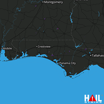
This weather event on August 20, 2025 includes:
3 states
29 counties,
17 cities,
and 62 zip codes.
There were 2111 total properties that were impacted and have possible damage.
States Impacted By Hail On August 20, 2025
Alabama
·
Florida
·
Georgia
Counties Impacted By Hail On August 20, 2025
Barbour, AL
·
Coffee, AL
·
Covington, AL
·
Crenshaw, AL
·
Dale, AL
·
Dallas, AL
·
Geneva, AL
·
Henry, AL
·
Houston, AL
·
Lowndes, AL
·
Monroe, AL
·
Pike, AL
·
Wilcox, AL
·
Bay, FL
·
Calhoun, FL
·
Gadsden, FL
·
Holmes, FL
·
Jackson, FL
·
Jefferson, FL
·
Leon, FL
·
Okaloosa, FL
·
Wakulla, FL
·
Walton, FL
·
Washington, FL
·
Baker, GA
·
Clay, GA
·
Decatur, GA
·
Miller, GA
·
Mitchell, GA
Cities Impacted By Hail On August 20, 2025
Beatrice, AL
·
Cottonwood, AL
·
DeFuniak Springs, FL
·
Ebro, FL
·
Enterprise, AL
·
Freeport, FL
·
Gretna, FL
·
Lowndesboro, AL
·
Lynn Haven, FL
·
Madrid, AL
·
Marianna, FL
·
Ozark, AL
·
Panama City, FL
·
Pinckard, AL
·
Pine Apple, AL
·
Quincy, FL
·
Vernon, FL
Zip Codes Impacted By Hail On August 20, 2025
31730
·
32327
·
32332
·
32333
·
32344
·
32351
·
32352
·
32404
·
32409
·
32413
·
32421
·
32424
·
32425
·
32426
·
32427
·
32428
·
32430
·
32431
·
32435
·
32437
·
32439
·
32440
·
32446
·
32448
·
32455
·
32462
·
32466
·
32539
·
32567
·
36009
·
36016
·
36034
·
36040
·
36048
·
36049
·
36079
·
36310
·
36316
·
36318
·
36320
·
36322
·
36323
·
36330
·
36343
·
36351
·
36360
·
36371
·
36375
·
36420
·
36421
·
36425
·
36442
·
36474
·
36752
·
36761
·
36768
·
39815
·
39837
·
39851
·
36301
·
32531
·
32438
 EGLIN AFB (KEVX) RADAR

