This weather event on August 20, 2025 includes:
1 states
21 counties,
17 cities,
and 59 zip codes.
There were 419 total properties that were impacted and have possible damage.
States Impacted By Hail On August 20, 2025
Texas
Counties Impacted By Hail On August 20, 2025
Bee, TX
·
Bell, TX
·
Burnet, TX
·
Coryell, TX
·
Falls, TX
·
Gonzales, TX
·
Grimes, TX
·
Kinney, TX
·
Lampasas, TX
·
Lee, TX
·
Limestone, TX
·
Madison, TX
·
Mason, TX
·
McLennan, TX
·
Mills, TX
·
Refugio, TX
·
Robertson, TX
·
San Patricio, TX
·
San Saba, TX
·
Travis, TX
·
Williamson, TX
Cities Impacted By Hail On August 20, 2025
Bremond, TX
·
Chilton, TX
·
Copperas Cove, TX
·
Fort Hood, TX
·
Golinda, TX
·
Hewitt, TX
·
Iola, TX
·
Jarrell, TX
·
Killeen, TX
·
Lorena, TX
·
Marlin, TX
·
Mason, TX
·
Robinson, TX
·
Temple, TX
·
Troy, TX
·
Waco, TX
·
Woodway, TX
Zip Codes Impacted By Hail On August 20, 2025
76501
·
76504
·
76522
·
76524
·
76527
·
76537
·
76539
·
76541
·
76542
·
76543
·
76544
·
76548
·
76549
·
76550
·
76557
·
76561
·
76571
·
76578
·
76579
·
76629
·
76630
·
76632
·
76643
·
76655
·
76656
·
76657
·
76661
·
76680
·
76682
·
76685
·
76706
·
76712
·
76832
·
76844
·
76856
·
76864
·
76877
·
77830
·
77831
·
77856
·
77861
·
77872
·
78368
·
78387
·
78389
·
78391
·
78393
·
78605
·
78608
·
78614
·
78621
·
78629
·
78633
·
78654
·
78669
·
78832
·
78947
·
76653
·
76687
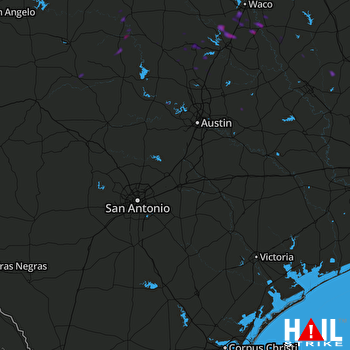 SAN ANTONIO (KEWX) RADAR

