This weather event on August 19, 2025 includes:
3 states
29 counties,
10 cities,
and 68 zip codes.
There were 616 total properties that were impacted and have possible damage.
States Impacted By Hail On August 19, 2025
Arkansas
·
Louisiana
·
Mississippi
Counties Impacted By Hail On August 19, 2025
Ashley, AR
·
Chicot, AR
·
East Baton Rouge, LA
·
East Carroll, LA
·
Madison, LA
·
Morehouse, LA
·
Ouachita, LA
·
Richland, LA
·
Tensas, LA
·
West Carroll, LA
·
Amite, MS
·
Bolivar, MS
·
Carroll, MS
·
Claiborne, MS
·
Covington, MS
·
Forrest, MS
·
Franklin, MS
·
Hinds, MS
·
Issaquena, MS
·
Jefferson, MS
·
Jefferson Davis, MS
·
Lafayette, MS
·
Panola, MS
·
Quitman, MS
·
Simpson, MS
·
Sunflower, MS
·
Tallahatchie, MS
·
Washington, MS
·
Yalobusha, MS
Cities Impacted By Hail On August 19, 2025
Boyle, MS
·
Central, LA
·
Cleveland, MS
·
Clinton, MS
·
Delhi, LA
·
Greenville, MS
·
Jackson, MS
·
Metcalfe, MS
·
Oak Ridge, LA
·
Petal, MS
Zip Codes Impacted By Hail On August 19, 2025
38606
·
38620
·
38643
·
38655
·
38658
·
38673
·
38701
·
38703
·
38725
·
38726
·
38730
·
38732
·
38736
·
38737
·
38738
·
38744
·
38756
·
38759
·
38760
·
38762
·
38768
·
38773
·
38901
·
38917
·
38927
·
38948
·
38963
·
38964
·
39056
·
39096
·
39111
·
39119
·
39140
·
39150
·
39154
·
39159
·
39175
·
39209
·
39212
·
39401
·
39428
·
39465
·
39474
·
39479
·
39652
·
39653
·
39661
·
70714
·
70818
·
71202
·
71220
·
71232
·
71237
·
71250
·
71254
·
71261
·
71263
·
71264
·
71266
·
71269
·
71286
·
71366
·
71640
·
71653
·
71661
·
71663
·
39170
·
39059
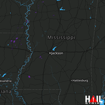 JACKSON (KDGX) RADAR

