This weather event on August 19, 2025 includes:
2 states
38 counties,
10 cities,
and 63 zip codes.
There were 36 total properties that were impacted and have possible damage.
States Impacted By Hail On August 19, 2025
New Mexico
·
Texas
Counties Impacted By Hail On August 19, 2025
Lea, NM
·
Andrews, TX
·
Borden, TX
·
Brewster, TX
·
Cochran, TX
·
Crane, TX
·
Crockett, TX
·
Crosby, TX
·
Culberson, TX
·
Dawson, TX
·
Ector, TX
·
Gaines, TX
·
Glasscock, TX
·
Hockley, TX
·
Howard, TX
·
Irion, TX
·
Jeff Davis, TX
·
Kent, TX
·
Loving, TX
·
Lubbock, TX
·
Lynn, TX
·
Martin, TX
·
Midland, TX
·
Pecos, TX
·
Reagan, TX
·
Reeves, TX
·
Runnels, TX
·
Schleicher, TX
·
Scurry, TX
·
Sterling, TX
·
Sutton, TX
·
Terrell, TX
·
Terry, TX
·
Tom Green, TX
·
Upton, TX
·
Val Verde, TX
·
Winkler, TX
·
Yoakum, TX
Cities Impacted By Hail On August 19, 2025
Ballinger, TX
·
Big Lake, TX
·
Eunice, NM
·
Hobbs, NM
·
Levelland, TX
·
Lovington, NM
·
Ozona, TX
·
Plains, TX
·
Slaton, TX
·
Sonora, TX
Zip Codes Impacted By Hail On August 19, 2025
76821
·
76875
·
76882
·
76901
·
76930
·
76932
·
76935
·
76936
·
76943
·
76950
·
76951
·
76958
·
78837
·
78871
·
79331
·
79336
·
79343
·
79355
·
79357
·
79360
·
79364
·
79372
·
79376
·
79379
·
79528
·
79538
·
79549
·
79567
·
79706
·
79713
·
79714
·
79718
·
79720
·
79731
·
79733
·
79734
·
79735
·
79738
·
79739
·
79741
·
79744
·
79745
·
79752
·
79754
·
79755
·
79759
·
79778
·
79781
·
79782
·
79830
·
79848
·
79855
·
79942
·
88231
·
88240
·
88242
·
88260
·
88262
·
88265
·
88267
·
76941
·
79346
·
79517
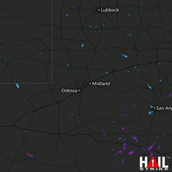 MIDLAND/ODSSA (KMAF) RADAR

