This weather event on August 18, 2025 includes:
3 states
22 counties,
20 cities,
and 82 zip codes.
There were 943 total properties that were impacted and have possible damage.
States Impacted By Hail On August 18, 2025
Minnesota
·
North Dakota
·
South Dakota
Counties Impacted By Hail On August 18, 2025
Grant, MN
·
Otter Tail, MN
·
Traverse, MN
·
Wilkin, MN
·
Barnes, ND
·
Cass, ND
·
Dickey, ND
·
Foster, ND
·
Grand Forks, ND
·
Griggs, ND
·
LaMoure, ND
·
Ransom, ND
·
Richland, ND
·
Sargent, ND
·
Sheridan, ND
·
Steele, ND
·
Stutsman, ND
·
Traill, ND
·
Wells, ND
·
Brown, SD
·
Marshall, SD
·
Roberts, SD
Cities Impacted By Hail On August 18, 2025
Alice, ND
·
Carrington, ND
·
De Lamere, ND
·
Elliott, ND
·
Enderlin, ND
·
Englevale, ND
·
Fergus Falls, MN
·
Glenfield, ND
·
Hatton, ND
·
Herman, MN
·
Jamestown, ND
·
Kensal, ND
·
Marion, ND
·
Portland, ND
·
Sheldon, ND
·
Spiritwood, ND
·
Sykeston, ND
·
Wolverton, MN
·
Wyndmere, ND
·
Ypsilanti, ND
Zip Codes Impacted By Hail On August 18, 2025
56248
·
56296
·
56514
·
56520
·
56537
·
56579
·
56594
·
57232
·
57247
·
57260
·
57270
·
57430
·
57446
·
58007
·
58008
·
58011
·
58013
·
58015
·
58017
·
58018
·
58027
·
58029
·
58031
·
58032
·
58033
·
58035
·
58046
·
58047
·
58051
·
58052
·
58053
·
58056
·
58057
·
58060
·
58063
·
58064
·
58065
·
58067
·
58071
·
58072
·
58077
·
58081
·
58228
·
58240
·
58257
·
58267
·
58274
·
58401
·
58416
·
58420
·
58421
·
58422
·
58425
·
58426
·
58429
·
58430
·
58431
·
58443
·
58444
·
58445
·
58448
·
58455
·
58458
·
58461
·
58463
·
58464
·
58466
·
58472
·
58474
·
58476
·
58479
·
58480
·
58481
·
58484
·
58486
·
58490
·
58492
·
58496
·
58497
·
58275
·
58068
·
58054
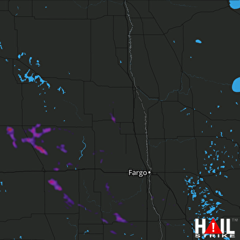 GRAND FORKS (KMVX) RADAR

