This weather event on August 18, 2025 includes:
2 states
22 counties,
16 cities,
and 69 zip codes.
There were 327 total properties that were impacted and have possible damage.
States Impacted By Hail On August 18, 2025
North Dakota
·
South Dakota
Counties Impacted By Hail On August 18, 2025
Barnes, ND
·
Dickey, ND
·
Foster, ND
·
Griggs, ND
·
LaMoure, ND
·
Ransom, ND
·
Sargent, ND
·
Sheridan, ND
·
Steele, ND
·
Stutsman, ND
·
Wells, ND
·
Brown, SD
·
Campbell, SD
·
Dewey, SD
·
Edmunds, SD
·
Haakon, SD
·
Perkins, SD
·
Potter, SD
·
Stanley, SD
·
Sully, SD
·
Walworth, SD
·
Ziebach, SD
Cities Impacted By Hail On August 18, 2025
Carrington, ND
·
Elliott, ND
·
Englevale, ND
·
Glenfield, ND
·
Grace City, ND
·
Kensal, ND
·
LaMoure, ND
·
Leal, ND
·
Lebanon, SD
·
Marion, ND
·
Pillsbury, ND
·
Spiritwood, ND
·
Spiritwood Lake, ND
·
Sykeston, ND
·
Verona, ND
·
Ypsilanti, ND
Zip Codes Impacted By Hail On August 18, 2025
57428
·
57442
·
57446
·
57450
·
57452
·
57455
·
57520
·
57532
·
57537
·
57552
·
57564
·
57620
·
57622
·
57623
·
57625
·
57626
·
57633
·
57636
·
57644
·
57649
·
58017
·
58027
·
58033
·
58040
·
58046
·
58049
·
58054
·
58056
·
58062
·
58064
·
58065
·
58069
·
58071
·
58072
·
58401
·
58416
·
58418
·
58420
·
58421
·
58422
·
58425
·
58426
·
58429
·
58430
·
58431
·
58443
·
58444
·
58445
·
58448
·
58455
·
58458
·
58461
·
58463
·
58464
·
58466
·
58472
·
58474
·
58476
·
58479
·
58480
·
58481
·
58484
·
58486
·
58490
·
58492
·
58496
·
58497
·
58063
·
58031
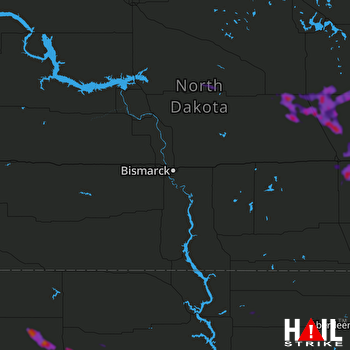 BISMARCK (KBIS) RADAR

