This weather event on August 18, 2025 includes:
2 states
29 counties,
21 cities,
and 66 zip codes.
There were 141 total properties that were impacted and have possible damage.
States Impacted By Hail On August 18, 2025
Alabama
·
Georgia
Counties Impacted By Hail On August 18, 2025
Autauga, AL
·
Bibb, AL
·
Butler, AL
·
Calhoun, AL
·
Cherokee, AL
·
Choctaw, AL
·
Clarke, AL
·
Clay, AL
·
Cleburne, AL
·
Coosa, AL
·
Dallas, AL
·
Elmore, AL
·
Etowah, AL
·
Greene, AL
·
Hale, AL
·
Jefferson, AL
·
Macon, AL
·
Marengo, AL
·
Montgomery, AL
·
Randolph, AL
·
Talladega, AL
·
Tallapoosa, AL
·
Tuscaloosa, AL
·
Wilcox, AL
·
Carroll, GA
·
Cobb, GA
·
Floyd, GA
·
Haralson, GA
·
Polk, GA
Cities Impacted By Hail On August 18, 2025
Altoona, AL
·
Ashland, AL
·
Bessemer, AL
·
Bowdon, GA
·
Bremen, GA
·
Camden, AL
·
Deatsville, AL
·
Franklin, AL
·
Gallant, AL
·
Hollins, AL
·
Holtville, AL
·
Lineville, AL
·
Montgomery, AL
·
Mount Zion, GA
·
Oxford, AL
·
Pine Level, AL
·
Selma, AL
·
Shorter, AL
·
Stewartville, AL
·
Tallassee, AL
·
Valley Grande, AL
Zip Codes Impacted By Hail On August 18, 2025
36763
·
35904
·
35150
·
30124
·
30064
·
30108
·
30110
·
30117
·
30125
·
30127
·
30152
·
30176
·
30182
·
35072
·
35111
·
35151
·
35160
·
35401
·
35405
·
35441
·
35456
·
35462
·
35463
·
35474
·
35952
·
35954
·
35960
·
35961
·
35972
·
36003
·
36006
·
36022
·
36024
·
36029
·
36037
·
36039
·
36043
·
36066
·
36067
·
36075
·
36078
·
36080
·
36083
·
36092
·
36108
·
36203
·
36207
·
36251
·
36258
·
36264
·
36266
·
36276
·
36545
·
36703
·
36720
·
36723
·
36726
·
36736
·
36759
·
36761
·
36768
·
36782
·
36784
·
36785
·
36853
·
36922
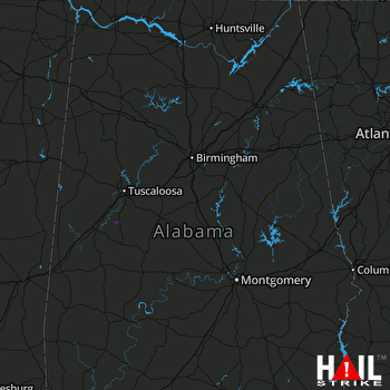 BIRMINGHAM (KBMX) RADAR

