This weather event on August 18, 2025 includes:
2 states
30 counties,
11 cities,
and 68 zip codes.
There were 23 total properties that were impacted and have possible damage.
States Impacted By Hail On August 18, 2025
New Mexico
·
Texas
Counties Impacted By Hail On August 18, 2025
Eddy, NM
·
Lea, NM
·
Andrews, TX
·
Borden, TX
·
Brewster, TX
·
Cochran, TX
·
Coke, TX
·
Crosby, TX
·
Culberson, TX
·
Dawson, TX
·
Fisher, TX
·
Gaines, TX
·
Garza, TX
·
Hale, TX
·
Hockley, TX
·
Howard, TX
·
Jeff Davis, TX
·
Jones, TX
·
Lynn, TX
·
Martin, TX
·
Mitchell, TX
·
Nolan, TX
·
Pecos, TX
·
Reeves, TX
·
Runnels, TX
·
Scurry, TX
·
Stonewall, TX
·
Taylor, TX
·
Terry, TX
·
Yoakum, TX
Cities Impacted By Hail On August 18, 2025
Abilene, TX
·
Andrews, TX
·
Big Spring, TX
·
Coahoma, TX
·
Fort Davis, TX
·
Levelland, TX
·
Roby, TX
·
Sand Springs, TX
·
Seminole, TX
·
Tatum, NM
·
Wilson, TX
Zip Codes Impacted By Hail On August 18, 2025
76933
·
76945
·
79250
·
79311
·
79316
·
79322
·
79323
·
79330
·
79331
·
79336
·
79342
·
79343
·
79345
·
79351
·
79355
·
79356
·
79357
·
79358
·
79359
·
79360
·
79367
·
79372
·
79373
·
79376
·
79379
·
79381
·
79407
·
79501
·
79502
·
79506
·
79511
·
79512
·
79517
·
79520
·
79526
·
79532
·
79534
·
79535
·
79536
·
79537
·
79541
·
79543
·
79545
·
79549
·
79556
·
79561
·
79566
·
79567
·
79603
·
79605
·
79606
·
79714
·
79720
·
79734
·
79735
·
79738
·
79831
·
79842
·
79847
·
79855
·
88220
·
88231
·
88260
·
88262
·
88267
·
79346
·
79363
·
79783
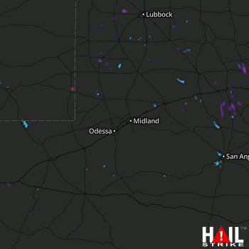 MIDLAND/ODSSA (KMAF) RADAR

