This weather event on August 17, 2025 includes:
2 states
33 counties,
10 cities,
and 80 zip codes.
There were 39 total properties that were impacted and have possible damage.
States Impacted By Hail On August 17, 2025
New Mexico
·
Texas
Counties Impacted By Hail On August 17, 2025
Chaves, NM
·
Eddy, NM
·
Lea, NM
·
Andrews, TX
·
Cochran, TX
·
Coke, TX
·
Concho, TX
·
Crane, TX
·
Culberson, TX
·
Dickens, TX
·
Ector, TX
·
Fisher, TX
·
Gaines, TX
·
Garza, TX
·
Hockley, TX
·
Irion, TX
·
Jeff Davis, TX
·
Loving, TX
·
Lubbock, TX
·
Lynn, TX
·
Menard, TX
·
Pecos, TX
·
Reeves, TX
·
Runnels, TX
·
Schleicher, TX
·
Sterling, TX
·
Stonewall, TX
·
Sutton, TX
·
Terry, TX
·
Tom Green, TX
·
Ward, TX
·
Winkler, TX
·
Yoakum, TX
Cities Impacted By Hail On August 17, 2025
Carlsbad, TX
·
Coyanosa, TX
·
Hobbs, NM
·
Lubbock, TX
·
Nadine, NM
·
New Deal, TX
·
San Angelo, TX
·
Shallowater, TX
·
Sonora, TX
·
Wilson, TX
Zip Codes Impacted By Hail On August 17, 2025
76821
·
76837
·
76866
·
76875
·
76882
·
76901
·
76903
·
76904
·
76934
·
76936
·
76941
·
76945
·
76950
·
76951
·
76958
·
79229
·
79311
·
79316
·
79323
·
79329
·
79336
·
79345
·
79350
·
79355
·
79356
·
79359
·
79360
·
79363
·
79379
·
79381
·
79401
·
79403
·
79404
·
79406
·
79407
·
79410
·
79411
·
79412
·
79413
·
79414
·
79415
·
79416
·
79423
·
79424
·
79502
·
79543
·
79556
·
79560
·
79714
·
79718
·
79719
·
79730
·
79731
·
79734
·
79741
·
79745
·
79756
·
79759
·
79766
·
79772
·
79780
·
79788
·
79847
·
79855
·
88203
·
88210
·
88220
·
88231
·
88240
·
88252
·
88256
·
88260
·
88264
·
88265
·
88267
·
76841
·
76935
·
79534
·
79735
·
79785
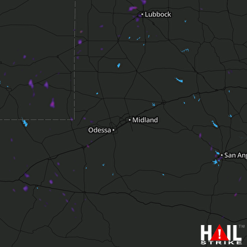 MIDLAND/ODSSA (KMAF) RADAR

