This weather event on August 16, 2025 includes:
3 states
18 counties,
27 cities,
and 69 zip codes.
There were total properties that were impacted and have possible damage.
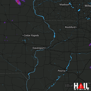 DAVENPORT (KDVN) RADAR
States Impacted By Hail On August 16, 2025
Iowa
·
Illinois
·
Wisconsin
Counties Impacted By Hail On August 16, 2025
Allamakee, IA
·
Benton, IA
·
Black Hawk, IA
·
Bremer, IA
·
Buchanan, IA
·
Fayette, IA
·
Grundy, IA
·
Howard, IA
·
Iowa, IA
·
Poweshiek, IA
·
Tama, IA
·
Winneshiek, IA
·
Ford, IL
·
Iroquois, IL
·
Kendall, IL
·
Livingston, IL
·
Will, IL
·
Iowa, WI
Cities Impacted By Hail On August 16, 2025
Aurora, IL
·
Bolingbrook, IL
·
Calmar, IA
·
Channahon, IL
·
Chatsworth, IL
·
Cresco, IA
·
Decorah, IA
·
Dike, IA
·
Dunkerton, IA
·
Forrest, IL
·
Fort Atkinson, IA
·
Holiday Lake, IA
·
Lockport, IL
·
Montgomery, IL
·
Naperville, IL
·
Ossian, IA
·
Oswego, IL
·
Piper City, IL
·
Plainfield, IL
·
Ridgeway, IA
·
Rockdale, IL
·
Shorewood, IL
·
Spillville, IA
·
Tama, IA
·
Toledo, IA
·
Waterloo, IA
·
Yorkville, IL
Zip Codes Impacted By Hail On August 16, 2025
50171
·
50173
·
50613
·
50624
·
50626
·
50629
·
50632
·
50651
·
50662
·
50664
·
50669
·
50674
·
50703
·
52101
·
52132
·
52133
·
52136
·
52144
·
52161
·
52162
·
52165
·
52168
·
52172
·
52175
·
52211
·
52215
·
52221
·
52222
·
52315
·
52316
·
52332
·
52339
·
52342
·
52346
·
52347
·
52349
·
53507
·
53544
·
60404
·
60410
·
60421
·
60431
·
60432
·
60436
·
60441
·
60447
·
60490
·
60512
·
60538
·
60543
·
60544
·
60545
·
60560
·
60564
·
60585
·
60586
·
60921
·
60929
·
60955
·
60959
·
60962
·
60968
·
61739
·
61741
·
61764
·
61769
·
50157
·
50643
·
60435

