This weather event on August 15, 2025 includes:
3 states
29 counties,
24 cities,
and 73 zip codes.
There were total properties that were impacted and have possible damage.
States Impacted By Hail On August 15, 2025
Alabama
·
Florida
·
Georgia
Counties Impacted By Hail On August 15, 2025
Autauga, AL
·
Baldwin, AL
·
Bibb, AL
·
Chilton, AL
·
Clarke, AL
·
Coosa, AL
·
Dallas, AL
·
Elmore, AL
·
Escambia, AL
·
Hale, AL
·
Marengo, AL
·
Perry, AL
·
Randolph, AL
·
Shelby, AL
·
Wilcox, AL
·
Escambia, FL
·
Jefferson, FL
·
Leon, FL
·
Liberty, FL
·
Madison, FL
·
Okaloosa, FL
·
Santa Rosa, FL
·
Wakulla, FL
·
Walton, FL
·
Washington, FL
·
Carroll, GA
·
Heard, GA
·
Troup, GA
·
Upson, GA
Cities Impacted By Hail On August 15, 2025
Atmore, AL
·
Bagdad, FL
·
Clanton, AL
·
Deatsville, AL
·
DeFuniak Springs, FL
·
East Milton, FL
·
Ephesus, GA
·
Faunsdale, AL
·
Franklin, GA
·
Fulton, AL
·
Jemison, AL
·
Marbury, AL
·
Marion, AL
·
Midway, FL
·
Navarre, FL
·
Newbern, AL
·
Pine Level, AL
·
Prattville, AL
·
The Rock, GA
·
Thomaston, AL
·
Thomasville, AL
·
Thorsby, AL
·
Uniontown, AL
·
Woodville, FL
Zip Codes Impacted By Hail On August 15, 2025
30108
·
30117
·
30170
·
30230
·
30256
·
30285
·
30286
·
31097
·
32305
·
32327
·
32331
·
32334
·
32336
·
32344
·
32350
·
32428
·
32433
·
32530
·
32561
·
32563
·
32566
·
32577
·
32583
·
35034
·
35040
·
35042
·
35045
·
35046
·
35072
·
35085
·
35136
·
35143
·
35151
·
35171
·
35183
·
36022
·
36051
·
36066
·
36067
·
36091
·
36280
·
36426
·
36441
·
36446
·
36451
·
36482
·
36502
·
36545
·
36567
·
36703
·
36720
·
36728
·
36736
·
36738
·
36744
·
36748
·
36754
·
36756
·
36759
·
36765
·
36769
·
36773
·
36782
·
36783
·
36784
·
36786
·
36792
·
36793
·
36750
·
36701
·
32340
·
30240
·
30217
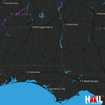 FORT RUCKER (KEOX) RADAR

