This weather event on August 15, 2025 includes:
3 states
28 counties,
13 cities,
and 69 zip codes.
There were 318 total properties that were impacted and have possible damage.
States Impacted By Hail On August 15, 2025
Arkansas
·
Louisiana
·
Texas
Counties Impacted By Hail On August 15, 2025
Bradley, AR
·
Calhoun, AR
·
Clark, AR
·
Cleveland, AR
·
Dallas, AR
·
Howard, AR
·
Pike, AR
·
Polk, AR
·
Union, AR
·
Beauregard, LA
·
Caldwell, LA
·
Claiborne, LA
·
De Soto, LA
·
Franklin, LA
·
Grant, LA
·
LaSalle, LA
·
Madison, LA
·
Natchitoches, LA
·
Rapides, LA
·
Richland, LA
·
Sabine, LA
·
Union, LA
·
Vernon, LA
·
Winn, LA
·
Angelina, TX
·
Panola, TX
·
Sabine, TX
·
Shelby, TX
Cities Impacted By Hail On August 15, 2025
Alexandria, LA
·
Ball, LA
·
Caddo Valley, AR
·
Carthage, AR
·
Kirby, AR
·
New Edinburg, AR
·
Okolona, AR
·
Pineville, LA
·
Pleasant Hill, LA
·
Prospect, LA
·
Rock Hill, LA
·
Rosepine, LA
·
St. Maurice, LA
Zip Codes Impacted By Hail On August 15, 2025
70634
·
70637
·
70656
·
70659
·
71052
·
71063
·
71065
·
71222
·
71232
·
71256
·
71259
·
71295
·
71303
·
71360
·
71371
·
71403
·
71404
·
71405
·
71417
·
71418
·
71424
·
71429
·
71430
·
71433
·
71435
·
71446
·
71447
·
71449
·
71450
·
71454
·
71456
·
71457
·
71465
·
71468
·
71479
·
71483
·
71485
·
71486
·
71631
·
71651
·
71652
·
71660
·
71665
·
71725
·
71744
·
71758
·
71763
·
71766
·
71921
·
71922
·
71923
·
71940
·
71943
·
71952
·
71962
·
71971
·
71973
·
72084
·
75639
·
75935
·
75948
·
75968
·
75974
·
75980
·
75975
·
71972
·
71423
·
71269
·
71019
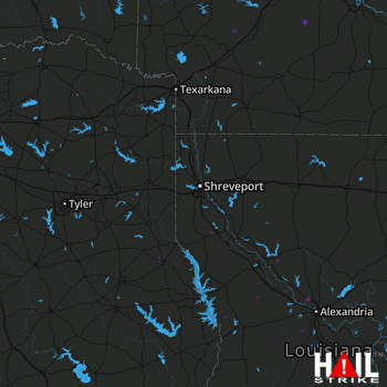 SHREVEPORT (KSHV) RADAR

