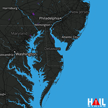
This weather event on August 13, 2025 includes:
4 states
15 counties,
27 cities,
and 54 zip codes.
There were 870 total properties that were impacted and have possible damage.
States Impacted By Hail On August 13, 2025
Delaware
·
Maryland
·
New Jersey
·
Pennsylvania
Counties Impacted By Hail On August 13, 2025
Kent, DE
·
New Castle, DE
·
Anne Arundel, MD
·
Baltimore, MD
·
Baltimore, MD
·
Harford, MD
·
Howard, MD
·
Salem, NJ
·
Adams, PA
·
Berks, PA
·
Bucks, PA
·
Chester, PA
·
Lancaster, PA
·
Lehigh, PA
·
York, PA
Cities Impacted By Hail On August 13, 2025
Arendtsville, PA
·
Baltimore, MD
·
Baltimore Highlands, MD
·
Bendersville, PA
·
Bernville, PA
·
Biglerville, PA
·
Brooklyn Park, MD
·
Brownstown, PA
·
Dauberville, PA
·
Delaware City, DE
·
Edgewood, MD
·
Flora Dale, PA
·
Fort Meade, MD
·
Jessup, MD
·
Joppatowne, MD
·
Kingsville, MD
·
Lancaster, PA
·
Leola, PA
·
Lititz, PA
·
Maryland City, MD
·
Middle River, MD
·
Perry Hall, MD
·
Pleasant Hills, MD
·
Rothsville, PA
·
Severn, MD
·
Smyrna, DE
·
Witmer, PA
Zip Codes Impacted By Hail On August 13, 2025
8038
·
8070
·
8079
·
17304
·
17306
·
17307
·
17324
·
17325
·
17363
·
17505
·
17522
·
17536
·
17543
·
17545
·
17563
·
17566
·
17601
·
17602
·
17606
·
18036
·
18069
·
18104
·
18951
·
19362
·
19363
·
19533
·
19541
·
19706
·
19709
·
19720
·
19734
·
19938
·
19977
·
20701
·
20724
·
20755
·
20794
·
21076
·
21085
·
21087
·
21111
·
21128
·
21156
·
21161
·
21162
·
21220
·
21224
·
21225
·
21226
·
21227
·
21230
·
21236
·
17540
·
19506
 DOVER AFB (KDOX) RADAR

