This weather event on August 13, 2025 includes:
1 states
30 counties,
7 cities,
and 66 zip codes.
There were 26 total properties that were impacted and have possible damage.
States Impacted By Hail On August 13, 2025
Texas
Counties Impacted By Hail On August 13, 2025
Bandera, TX
·
Blanco, TX
·
Burnet, TX
·
Callahan, TX
·
Coke, TX
·
Coleman, TX
·
Concho, TX
·
Crockett, TX
·
Eastland, TX
·
Edwards, TX
·
Gillespie, TX
·
Kendall, TX
·
Kerr, TX
·
Kimble, TX
·
Kinney, TX
·
Lampasas, TX
·
Llano, TX
·
Mason, TX
·
McCulloch, TX
·
Medina, TX
·
Menard, TX
·
Mills, TX
·
Nolan, TX
·
Real, TX
·
San Saba, TX
·
Schleicher, TX
·
Sutton, TX
·
Taylor, TX
·
Uvalde, TX
·
Val Verde, TX
Cities Impacted By Hail On August 13, 2025
Buchanan Dam, TX
·
Buchanan Lake Village, TX
·
Del Rio, TX
·
Ingram, TX
·
Laughlin AFB, TX
·
Ranger, TX
·
Stonewall, TX
Zip Codes Impacted By Hail On August 13, 2025
76435
·
76445
·
76448
·
76454
·
76470
·
76824
·
76828
·
76832
·
76842
·
76844
·
76848
·
76849
·
76853
·
76854
·
76859
·
76862
·
76864
·
76869
·
76870
·
76871
·
76872
·
76877
·
76885
·
76887
·
76936
·
76943
·
76950
·
78006
·
78010
·
78024
·
78025
·
78027
·
78028
·
78055
·
78058
·
78606
·
78607
·
78609
·
78611
·
78618
·
78624
·
78631
·
78636
·
78643
·
78663
·
78671
·
78672
·
78675
·
78828
·
78832
·
78833
·
78837
·
78840
·
78843
·
78850
·
78861
·
78873
·
78884
·
78885
·
79504
·
79506
·
79541
·
76550
·
76856
·
76874
·
78880
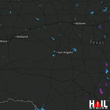 SAN ANGELO (KSJT) RADAR

