This weather event on August 12, 2025 includes:
2 states
19 counties,
23 cities,
and 58 zip codes.
There were total properties that were impacted and have possible damage.
States Impacted By Hail On August 12, 2025
Kentucky
·
Tennessee
Counties Impacted By Hail On August 12, 2025
Butler, KY
·
Edmonson, KY
·
Grayson, KY
·
Green, KY
·
Hardin, KY
·
Hart, KY
·
Logan, KY
·
Metcalfe, KY
·
Simpson, KY
·
Benton, TN
·
Cheatham, TN
·
Davidson, TN
·
Dickson, TN
·
Henry, TN
·
Humphreys, TN
·
Macon, TN
·
Montgomery, TN
·
Robertson, TN
·
Sumner, TN
Cities Impacted By Hail On August 12, 2025
Adams, TN
·
Coopertown, TN
·
Cross Plains, TN
·
Franklin, KY
·
Gallatin, TN
·
Goodlettsville, TN
·
Graball, TN
·
Greenbrier, TN
·
Hendersonville, TN
·
Leitchfield, KY
·
Millersville, TN
·
Munfordville, KY
·
Nashville-Davidson metropolitan government (balance), TN
·
New Deal, TN
·
Orlinda, TN
·
Pleasant View, TN
·
Portland, TN
·
Ridgetop, TN
·
Shackle Island, TN
·
Springfield, TN
·
Walnut Grove, TN
·
Westmoreland, TN
·
White House, TN
Zip Codes Impacted By Hail On August 12, 2025
37022
·
37032
·
37035
·
37036
·
37040
·
37043
·
37048
·
37051
·
37052
·
37055
·
37066
·
37072
·
37073
·
37075
·
37080
·
37101
·
37141
·
37146
·
37148
·
37171
·
37172
·
37186
·
37188
·
37189
·
37207
·
37218
·
38221
·
38256
·
38320
·
38333
·
42127
·
42134
·
42202
·
42204
·
42207
·
42210
·
42214
·
42259
·
42261
·
42265
·
42275
·
42285
·
42712
·
42721
·
42722
·
42726
·
42729
·
42743
·
42746
·
42749
·
42754
·
42765
·
42776
·
42784
·
37010
·
37015
·
37049
·
42713
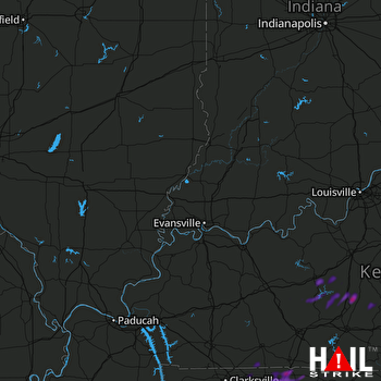 EVANSVILLE (KVWX) RADAR

