This weather event on August 12, 2025 includes:
4 states
29 counties,
17 cities,
and 61 zip codes.
There were total properties that were impacted and have possible damage.
States Impacted By Hail On August 12, 2025
Alabama
·
Georgia
·
Kentucky
·
Tennessee
Counties Impacted By Hail On August 12, 2025
Cherokee, AL
·
Clay, AL
·
Talladega, AL
·
Barrow, GA
·
Cobb, GA
·
Coweta, GA
·
DeKalb, GA
·
Douglas, GA
·
Forsyth, GA
·
Habersham, GA
·
Jackson, GA
·
Lumpkin, GA
·
Paulding, GA
·
Rabun, GA
·
White, GA
·
Christian, KY
·
Todd, KY
·
Benton, TN
·
Carroll, TN
·
Coffee, TN
·
Decatur, TN
·
Giles, TN
·
Henderson, TN
·
Hickman, TN
·
Houston, TN
·
Humphreys, TN
·
Maury, TN
·
Montgomery, TN
·
Perry, TN
Cities Impacted By Hail On August 12, 2025
Auburn, GA
·
Avondale Estates, GA
·
Carl, GA
·
Chesterfield, TN
·
Clarkston, GA
·
Darden, TN
·
Decatur, GA
·
Douglasville, GA
·
East Newnan, GA
·
Hoschton, GA
·
Kennesaw, GA
·
Newnan, GA
·
North Decatur, GA
·
Oak Grove, KY
·
Pembroke, KY
·
Scottdale, GA
·
Tucker, GA
Zip Codes Impacted By Hail On August 12, 2025
30011
·
30021
·
30030
·
30033
·
30040
·
30060
·
30064
·
30066
·
30079
·
30084
·
30127
·
30134
·
30144
·
30263
·
30265
·
30523
·
30528
·
30533
·
30548
·
30552
·
30571
·
30576
·
30680
·
35044
·
35151
·
35160
·
35903
·
35960
·
35983
·
36255
·
36272
·
36276
·
37033
·
37040
·
37061
·
37078
·
37097
·
37101
·
37140
·
37185
·
37355
·
38221
·
38318
·
38328
·
38329
·
38333
·
38344
·
38351
·
38363
·
38387
·
38390
·
38401
·
38477
·
38478
·
42220
·
42234
·
42262
·
42266
·
42286
·
30152
·
30062
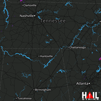 HUNTSVILLE (KHTX) RADAR

