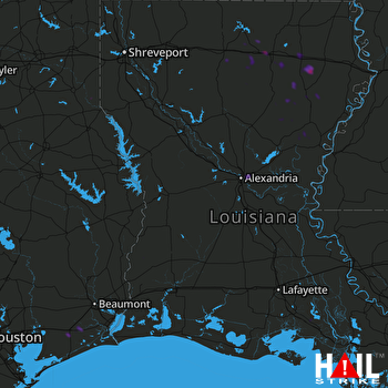
This weather event on August 12, 2025 includes:
3 states
28 counties,
15 cities,
and 66 zip codes.
There were total properties that were impacted and have possible damage.
States Impacted By Hail On August 12, 2025
Louisiana
·
Mississippi
·
Texas
Counties Impacted By Hail On August 12, 2025
Beauregard, LA
·
Caldwell, LA
·
Cameron, LA
·
Catahoula, LA
·
Concordia, LA
·
De Soto, LA
·
East Feliciana, LA
·
Franklin, LA
·
Iberia, LA
·
Jackson, LA
·
LaSalle, LA
·
Lincoln, LA
·
Madison, LA
·
Natchitoches, LA
·
Ouachita, LA
·
Rapides, LA
·
Richland, LA
·
St. Mary, LA
·
Tensas, LA
·
Union, LA
·
Adams, MS
·
Franklin, MS
·
Warren, MS
·
Chambers, TX
·
Jefferson, TX
·
Newton, TX
·
Panola, TX
·
Shelby, TX
Cities Impacted By Hail On August 12, 2025
Alexandria, LA
·
Brownsville, LA
·
Calhoun, LA
·
Claiborne, LA
·
Downsville, LA
·
Jeanerette, LA
·
Monroe, LA
·
Pineville, LA
·
Rayville, LA
·
Richwood, LA
·
Stowell, TX
·
Vicksburg, MS
·
Wallace Ridge, LA
·
West Monroe, LA
·
Winnie, TX
Zip Codes Impacted By Hail On August 12, 2025
39120
·
39180
·
39661
·
70544
·
70552
·
70563
·
70582
·
70632
·
70634
·
70653
·
70657
·
70730
·
71031
·
71063
·
71070
·
71201
·
71202
·
71219
·
71225
·
71227
·
71232
·
71234
·
71238
·
71241
·
71243
·
71259
·
71264
·
71269
·
71270
·
71282
·
71291
·
71292
·
71295
·
71301
·
71302
·
71303
·
71326
·
71334
·
71336
·
71340
·
71343
·
71357
·
71360
·
71368
·
71401
·
71409
·
71411
·
71418
·
71425
·
71435
·
71441
·
71447
·
71455
·
71457
·
71465
·
71468
·
75633
·
75974
·
77514
·
77612
·
77622
·
77661
·
77665
·
77705
·
71226
·
70631
 FORT POLK (KPOE) RADAR

