This weather event on August 12, 2025 includes:
1 states
34 counties,
11 cities,
and 85 zip codes.
There were 184 total properties that were impacted and have possible damage.
States Impacted By Hail On August 12, 2025
Texas
Counties Impacted By Hail On August 12, 2025
Brown, TX
·
Burnet, TX
·
Callahan, TX
·
Coleman, TX
·
Comanche, TX
·
Concho, TX
·
Coryell, TX
·
Crockett, TX
·
Eastland, TX
·
Edwards, TX
·
Erath, TX
·
Garza, TX
·
Gillespie, TX
·
Hamilton, TX
·
Kendall, TX
·
Kent, TX
·
Kerr, TX
·
Kimble, TX
·
Kinney, TX
·
Lampasas, TX
·
Llano, TX
·
Mason, TX
·
McCulloch, TX
·
Menard, TX
·
Mills, TX
·
Pecos, TX
·
Real, TX
·
San Saba, TX
·
Schleicher, TX
·
Sutton, TX
·
Terrell, TX
·
Tom Green, TX
·
Uvalde, TX
·
Val Verde, TX
Cities Impacted By Hail On August 12, 2025
Buchanan Dam, TX
·
Burnet, TX
·
Eden, TX
·
Evant, TX
·
Goldthwaite, TX
·
Granite Shoals, TX
·
Highland Haven, TX
·
Horseshoe Bay, TX
·
Leakey, TX
·
Menard, TX
·
Sunrise Beach Village, TX
Zip Codes Impacted By Hail On August 12, 2025
76436
·
76437
·
76442
·
76443
·
76444
·
76446
·
76452
·
76454
·
76455
·
76469
·
76471
·
76474
·
76525
·
76528
·
76531
·
76550
·
76565
·
76801
·
76824
·
76827
·
76828
·
76831
·
76832
·
76834
·
76837
·
76844
·
76849
·
76852
·
76853
·
76854
·
76856
·
76858
·
76859
·
76864
·
76866
·
76873
·
76874
·
76877
·
76878
·
76935
·
76936
·
76943
·
76950
·
78013
·
78024
·
78025
·
78028
·
78055
·
78058
·
78605
·
78606
·
78609
·
78611
·
78618
·
78624
·
78631
·
78639
·
78643
·
78654
·
78657
·
78671
·
78801
·
78828
·
78832
·
78833
·
78837
·
78838
·
78840
·
78851
·
78870
·
78871
·
78879
·
78880
·
78881
·
78884
·
79356
·
79504
·
79528
·
79743
·
79744
·
79781
·
79848
·
79735
·
78873
·
76870
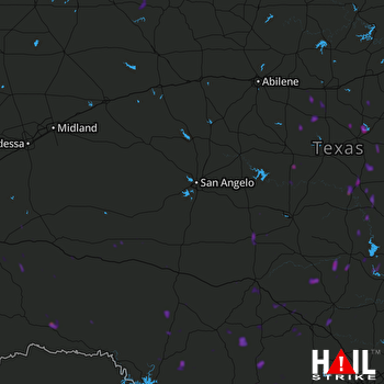 SAN ANGELO (KSJT) RADAR

