This weather event on August 10, 2025 includes:
3 states
16 counties,
27 cities,
and 54 zip codes.
There were 1281 total properties that were impacted and have possible damage.
States Impacted By Hail On August 10, 2025
Iowa
·
Illinois
·
Wisconsin
Counties Impacted By Hail On August 10, 2025
Clinton, IA
·
Dubuque, IA
·
Jackson, IA
·
Boone, IL
·
Jo Daviess, IL
·
Lake, IL
·
Ogle, IL
·
Whiteside, IL
·
Winnebago, IL
·
Grant, WI
·
Iowa, WI
·
Kenosha, WI
·
Lafayette, WI
·
Racine, WI
·
Rock, WI
·
Sauk, WI
Cities Impacted By Hail On August 10, 2025
Arena, WI
·
Asbury, IA
·
Beach Park, IL
·
Beloit, WI
·
Cobb, WI
·
Como, IL
·
Dickeyville, WI
·
Dubuque, IA
·
Durango, IA
·
Gurnee, IL
·
Kieler, WI
·
Lake Bluff, IL
·
Lake Forest, IL
·
Lincolnshire, IL
·
Lost Nation, IA
·
Machesney Park, IL
·
Mettawa, IL
·
North Chicago, IL
·
Platteville, WI
·
Rock Falls, IL
·
Roscoe, IL
·
Sageville, IA
·
Sterling, IL
·
Timberlane, IL
·
Waukegan, IL
·
Winthrop Harbor, IL
·
Zion, IL
Zip Codes Impacted By Hail On August 10, 2025
52001
·
52002
·
52039
·
52060
·
52073
·
52207
·
52254
·
52323
·
52777
·
53105
·
53168
·
53503
·
53506
·
53507
·
53510
·
53511
·
53517
·
53526
·
53530
·
53533
·
53543
·
53553
·
53554
·
53565
·
53569
·
53582
·
53583
·
53807
·
53808
·
53811
·
53813
·
53818
·
53820
·
60031
·
60044
·
60045
·
60083
·
60087
·
60088
·
60096
·
60099
·
61008
·
61010
·
61011
·
61025
·
61036
·
61037
·
61071
·
61073
·
61081
·
61084
·
61102
·
61277
·
61283
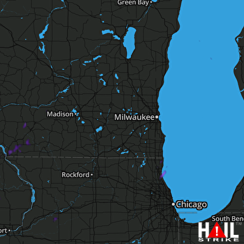 MILWAUKEE (KMKX) RADAR

