This weather event on August 10, 2025 includes:
3 states
23 counties,
11 cities,
and 66 zip codes.
There were 24 total properties that were impacted and have possible damage.
States Impacted By Hail On August 10, 2025
Colorado
·
Nebraska
·
South Dakota
Counties Impacted By Hail On August 10, 2025
Logan, CO
·
Phillips, CO
·
Sedgwick, CO
·
Arthur, NE
·
Chase, NE
·
Cherry, NE
·
Cheyenne, NE
·
Custer, NE
·
Dawson, NE
·
Deuel, NE
·
Dundy, NE
·
Frontier, NE
·
Garden, NE
·
Grant, NE
·
Hayes, NE
·
Hitchcock, NE
·
Hooker, NE
·
Keith, NE
·
Lincoln, NE
·
Morrill, NE
·
Perkins, NE
·
Red Willow, NE
·
Oglala Lakota, SD
Cities Impacted By Hail On August 10, 2025
Brady, NE
·
Cozad, NE
·
Enders, NE
·
Gothenburg, NE
·
Grant, NE
·
Imperial, NE
·
Lodgepole, NE
·
Lorenzo, NE
·
McCook, NE
·
North Platte, NE
·
Wauneta, NE
Zip Codes Impacted By Hail On August 10, 2025
57752
·
57756
·
57772
·
68825
·
69001
·
69021
·
69023
·
69024
·
69027
·
69030
·
69032
·
69033
·
69034
·
69038
·
69040
·
69041
·
69043
·
69044
·
69101
·
69120
·
69121
·
69123
·
69125
·
69127
·
69129
·
69131
·
69132
·
69134
·
69138
·
69140
·
69141
·
69143
·
69144
·
69146
·
69147
·
69148
·
69149
·
69150
·
69151
·
69152
·
69154
·
69155
·
69156
·
69162
·
69165
·
69168
·
69169
·
69170
·
69218
·
69331
·
69334
·
69336
·
69343
·
69350
·
69366
·
80721
·
80726
·
80731
·
80734
·
80737
·
80744
·
80749
·
69029
·
69045
·
69130
·
80747
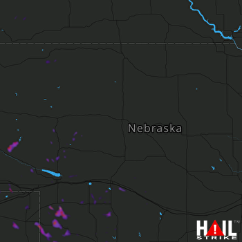 NORTH PLATTE (KLNX) RADAR

