This weather event on August 10, 2025 includes:
3 states
19 counties,
16 cities,
and 57 zip codes.
There were total properties that were impacted and have possible damage.
States Impacted By Hail On August 10, 2025
Iowa
·
Illinois
·
Missouri
Counties Impacted By Hail On August 10, 2025
Lee, IA
·
Brown, IL
·
Cass, IL
·
Fulton, IL
·
Logan, IL
·
Mason, IL
·
Menard, IL
·
Schuyler, IL
·
Tazewell, IL
·
Benton, MO
·
Bollinger, MO
·
Camden, MO
·
Cape Girardeau, MO
·
Clark, MO
·
Hickory, MO
·
Miller, MO
·
Perry, MO
·
Pettis, MO
·
Saline, MO
Cities Impacted By Hail On August 10, 2025
Camdenton, MO
·
Chandlerville, IL
·
Cross Timbers, MO
·
Kahoka, MO
·
Macks Creek, MO
·
Mason City, IL
·
Mount Sterling, IL
·
Oakford, IL
·
Osage Beach, MO
·
Pekin, IL
·
Sedalia, MO
·
Smithton, MO
·
St. Francisville, MO
·
Sunrise Beach, MO
·
Village of Four Seasons, MO
·
Virginia, IL
Zip Codes Impacted By Hail On August 10, 2025
52619
·
52632
·
52639
·
61501
·
61532
·
61534
·
61546
·
61554
·
61568
·
61734
·
62353
·
62617
·
62618
·
62627
·
62633
·
62639
·
62655
·
62664
·
62673
·
62675
·
62681
·
62688
·
62691
·
63430
·
63453
·
63465
·
63474
·
63743
·
63775
·
63781
·
65017
·
65047
·
65049
·
65052
·
65065
·
65079
·
65082
·
65083
·
65301
·
65324
·
65326
·
65332
·
65333
·
65334
·
65335
·
65347
·
65350
·
65351
·
65355
·
65591
·
65634
·
65732
·
65786
·
65787
·
62682
·
63445
·
65020
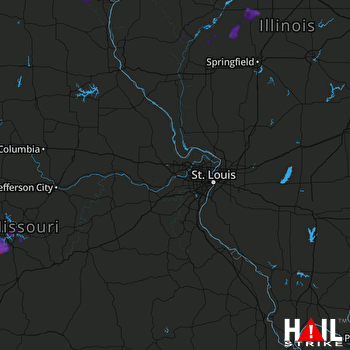 ST LOUIS (KLSX) RADAR

