This weather event on August 10, 2025 includes:
5 states
32 counties,
14 cities,
and 70 zip codes.
There were 494 total properties that were impacted and have possible damage.
States Impacted By Hail On August 10, 2025
Colorado
·
Kansas
·
New Mexico
·
Oklahoma
·
Texas
Counties Impacted By Hail On August 10, 2025
Baca, CO
·
Meade, KS
·
Morton, KS
·
Seward, KS
·
Stevens, KS
·
Harding, NM
·
Roosevelt, NM
·
Union, NM
·
Beaver, OK
·
Cimarron, OK
·
Ellis, OK
·
Texas, OK
·
Armstrong, TX
·
Bailey, TX
·
Briscoe, TX
·
Castro, TX
·
Cochran, TX
·
Dallam, TX
·
Dickens, TX
·
Floyd, TX
·
Hansford, TX
·
Hartley, TX
·
King, TX
·
Lamb, TX
·
Lipscomb, TX
·
Moore, TX
·
Motley, TX
·
Oldham, TX
·
Potter, TX
·
Randall, TX
·
Sherman, TX
·
Swisher, TX
Cities Impacted By Hail On August 10, 2025
Cactus, TX
·
Causey, NM
·
Dora, NM
·
Guymon, OK
·
Hartley, TX
·
Hooker, OK
·
Hugoton, KS
·
Liberal, KS
·
Optima, OK
·
Portales, NM
·
Stratford, TX
·
Sunray, TX
·
Texline, TX
·
Tyrone, OK
Zip Codes Impacted By Hail On August 10, 2025
67855
·
67864
·
67869
·
67901
·
67950
·
67951
·
67952
·
67953
·
73843
·
73844
·
73848
·
73932
·
73933
·
73937
·
73938
·
73939
·
73942
·
73945
·
73946
·
73950
·
73951
·
79001
·
79010
·
79012
·
79013
·
79018
·
79019
·
79022
·
79029
·
79031
·
79034
·
79040
·
79042
·
79044
·
79058
·
79081
·
79084
·
79086
·
79087
·
79088
·
79108
·
79124
·
79201
·
79220
·
79229
·
79234
·
79235
·
79241
·
79248
·
79255
·
79257
·
79324
·
79339
·
79346
·
79347
·
79371
·
81090
·
87733
·
88113
·
88125
·
88132
·
88410
·
88415
·
88424
·
88426
·
67859
·
67954
·
79226
·
79344
·
88130
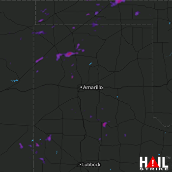 AMARILLO (KAMA) RADAR

