This weather event on August 9, 2025 includes:
3 states
18 counties,
23 cities,
and 66 zip codes.
There were 114 total properties that were impacted and have possible damage.
States Impacted By Hail On August 9, 2025
Iowa
·
Kansas
·
Missouri
Counties Impacted By Hail On August 9, 2025
Decatur, IA
·
Page, IA
·
Ringgold, IA
·
Taylor, IA
·
Doniphan, KS
·
Shawnee, KS
·
Wyandotte, KS
·
Andrew, MO
·
Buchanan, MO
·
Clay, MO
·
Clinton, MO
·
Daviess, MO
·
DeKalb, MO
·
Gentry, MO
·
Harrison, MO
·
Holt, MO
·
Nodaway, MO
·
Platte, MO
Cities Impacted By Hail On August 9, 2025
Altamont, MO
·
College Springs, IA
·
Country Club, MO
·
Edgerton, MO
·
Fillmore, MO
·
Graham, MO
·
Guilford, MO
·
Kansas City, KS
·
Kansas City, MO
·
Lake Viking, MO
·
Maitland, MO
·
Maryville, MO
·
McFall, MO
·
Mound City, MO
·
Osborn, MO
·
Ridgely, MO
·
Rosendale, MO
·
Severance, KS
·
Smithville, MO
·
St. Joseph, MO
·
Sun Valley Lake, IA
·
Trimble, MO
·
Winston, MO
Zip Codes Impacted By Hail On August 9, 2025
50074
·
50108
·
50841
·
50848
·
50851
·
50854
·
50860
·
50862
·
51630
·
51632
·
51636
·
51637
·
64089
·
64154
·
64402
·
64421
·
64423
·
64424
·
64429
·
64430
·
64436
·
64438
·
64444
·
64449
·
64454
·
64455
·
64457
·
64463
·
64466
·
64468
·
64469
·
64470
·
64471
·
64473
·
64474
·
64477
·
64480
·
64483
·
64485
·
64487
·
64489
·
64490
·
64492
·
64497
·
64501
·
64503
·
64504
·
64505
·
64506
·
64507
·
64620
·
64636
·
64640
·
64647
·
64657
·
64670
·
64689
·
66002
·
66008
·
66017
·
66087
·
66111
·
66409
·
66090
·
64649
·
64427
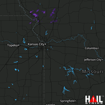 KANSAS CITY (KEAX) RADAR

