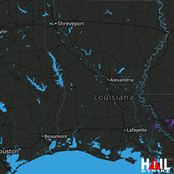
This weather event on August 7, 2025 includes:
1 states
16 counties,
23 cities,
and 62 zip codes.
There were total properties that were impacted and have possible damage.
States Impacted By Hail On August 7, 2025
Louisiana
Counties Impacted By Hail On August 7, 2025
Acadia, LA
·
Allen, LA
·
Ascension, LA
·
Beauregard, LA
·
Calcasieu, LA
·
Cameron, LA
·
East Baton Rouge, LA
·
East Feliciana, LA
·
Evangeline, LA
·
Iberia, LA
·
Iberville, LA
·
Livingston, LA
·
St. Martin, LA
·
Vermilion, LA
·
Vernon, LA
·
West Baton Rouge, LA
Cities Impacted By Hail On August 7, 2025
Baker, LA
·
Baton Rouge, LA
·
Brownfields, LA
·
Central, LA
·
Clinton, LA
·
Denham Springs, LA
·
French Settlement, LA
·
Gardere, LA
·
Gonzales, LA
·
Inniswold, LA
·
Livingston, LA
·
Maringouin, LA
·
Merrydale, LA
·
Old Jefferson, LA
·
Plaquemine, LA
·
Port Vincent, LA
·
Prairieville, LA
·
Reeves, LA
·
Rosedale, LA
·
Shenandoah, LA
·
Village St. George, LA
·
Walker, LA
·
Zachary, LA
Zip Codes Impacted By Hail On August 7, 2025
70510
·
70513
·
70515
·
70528
·
70533
·
70535
·
70548
·
70555
·
70560
·
70643
·
70645
·
70648
·
70651
·
70652
·
70655
·
70656
·
70657
·
70658
·
70665
·
70710
·
70714
·
70719
·
70722
·
70726
·
70730
·
70733
·
70734
·
70737
·
70740
·
70744
·
70748
·
70754
·
70757
·
70764
·
70767
·
70769
·
70770
·
70772
·
70774
·
70777
·
70780
·
70788
·
70789
·
70791
·
70802
·
70806
·
70807
·
70808
·
70809
·
70810
·
70811
·
70812
·
70815
·
70816
·
70817
·
70818
·
70819
·
70820
·
71403
·
70814
·
70805
·
70634
 FORT POLK (KPOE) RADAR

