This weather event on August 7, 2025 includes:
2 states
17 counties,
20 cities,
and 48 zip codes.
There were total properties that were impacted and have possible damage.
States Impacted By Hail On August 7, 2025
Florida
·
Georgia
Counties Impacted By Hail On August 7, 2025
Alachua, FL
·
Baker, FL
·
Citrus, FL
·
Columbia, FL
·
Dixie, FL
·
Gilchrist, FL
·
Hamilton, FL
·
Hernando, FL
·
Lake, FL
·
Levy, FL
·
Madison, FL
·
Marion, FL
·
Sumter, FL
·
Taylor, FL
·
Charlton, GA
·
Clinch, GA
·
Lowndes, GA
Cities Impacted By Hail On August 7, 2025
Andrews, FL
·
Brookridge, FL
·
Citrus Springs, FL
·
Crystal River, FL
·
Fanning Springs, FL
·
Five Points, FL
·
Hernando, FL
·
High Point, FL
·
Homosassa, FL
·
Homosassa Springs, FL
·
Lake City, FL
·
Lecanto, FL
·
Manatee Road, FL
·
Newberry, FL
·
North Weeki Wachee, FL
·
South Brooksville, FL
·
Spring Hill, FL
·
Sugarmill Woods, FL
·
Williston Highlands, FL
·
Wiscon, FL
Zip Codes Impacted By Hail On August 7, 2025
31562
·
31601
·
31634
·
31636
·
32053
·
32055
·
32350
·
32356
·
32359
·
32618
·
32619
·
32621
·
32625
·
32626
·
32628
·
32639
·
32648
·
32668
·
32669
·
32680
·
32693
·
32696
·
33538
·
34428
·
34429
·
34431
·
34432
·
34433
·
34434
·
34442
·
34446
·
34448
·
34449
·
34461
·
34473
·
34481
·
34484
·
34491
·
34601
·
34604
·
34608
·
34609
·
34613
·
34614
·
34711
·
34714
·
34736
·
34785
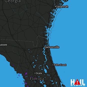 JACKSONVILLE (KJAX) RADAR

