This weather event on August 4, 2025 includes:
1 states
22 counties,
17 cities,
and 59 zip codes.
There were 2363 total properties that were impacted and have possible damage.
States Impacted By Hail On August 4, 2025
Montana
Counties Impacted By Hail On August 4, 2025
Blaine, MT
·
Cascade, MT
·
Chouteau, MT
·
Deer Lodge, MT
·
Fergus, MT
·
Flathead, MT
·
Glacier, MT
·
Golden Valley, MT
·
Granite, MT
·
Hill, MT
·
Jefferson, MT
·
Judith Basin, MT
·
Lewis and Clark, MT
·
Meagher, MT
·
Missoula, MT
·
Musselshell, MT
·
Pondera, MT
·
Powell, MT
·
Sweet Grass, MT
·
Teton, MT
·
Toole, MT
·
Wheatland, MT
Cities Impacted By Hail On August 4, 2025
Anaconda-Deer Lodge County, MT
·
Azure, MT
·
Black Eagle, MT
·
Dupuyer, MT
·
Fort Benton, MT
·
Gibson Flats, MT
·
Great Falls, MT
·
Havre, MT
·
Havre North, MT
·
Highwood, MT
·
Malmstrom AFB, MT
·
North Browning, MT
·
Philipsburg, MT
·
Sangrey, MT
·
Shawmut, MT
·
Stockett, MT
·
Ulm, MT
Zip Codes Impacted By Hail On August 4, 2025
59046
·
59055
·
59074
·
59078
·
59401
·
59404
·
59405
·
59412
·
59414
·
59417
·
59419
·
59421
·
59422
·
59424
·
59425
·
59427
·
59432
·
59433
·
59440
·
59442
·
59446
·
59447
·
59448
·
59450
·
59451
·
59457
·
59460
·
59462
·
59463
·
59464
·
59465
·
59467
·
59469
·
59472
·
59479
·
59480
·
59482
·
59485
·
59486
·
59501
·
59520
·
59521
·
59523
·
59525
·
59528
·
59632
·
59638
·
59645
·
59648
·
59711
·
59722
·
59733
·
59832
·
59858
·
59868
·
59919
·
59826
·
59430
·
59410
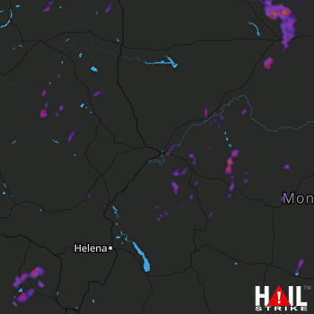 GREAT FALLS (KTFX) RADAR

