This weather event on August 3, 2025 includes:
3 states
24 counties,
20 cities,
and 62 zip codes.
There were 13 total properties that were impacted and have possible damage.
States Impacted By Hail On August 3, 2025
Kansas
·
Nebraska
·
South Dakota
Counties Impacted By Hail On August 3, 2025
Jewell, KS
·
Adams, NE
·
Antelope, NE
·
Boone, NE
·
Cedar, NE
·
Clay, NE
·
Franklin, NE
·
Garfield, NE
·
Greeley, NE
·
Hall, NE
·
Hamilton, NE
·
Howard, NE
·
Kearney, NE
·
Knox, NE
·
Madison, NE
·
Merrick, NE
·
Nance, NE
·
Nuckolls, NE
·
Pierce, NE
·
Webster, NE
·
Wheeler, NE
·
Bon Homme, SD
·
Hutchinson, SD
·
Yankton, SD
Cities Impacted By Hail On August 3, 2025
Archer, NE
·
Aten, NE
·
Bloomfield, NE
·
Cedar Rapids, NE
·
Center, NE
·
Chapman, NE
·
Foster, NE
·
Grand Island, NE
·
Hastings, NE
·
Inland, NE
·
Meadow Grove, NE
·
Osmond, NE
·
Palmer, NE
·
Phillips, NE
·
Plainview, NE
·
Scotland, SD
·
Springfield, SD
·
St. Libory, NE
·
Tilden, NE
·
Wausa, NE
Zip Codes Impacted By Hail On August 3, 2025
57040
·
57045
·
57059
·
57062
·
57063
·
57066
·
57067
·
66936
·
68620
·
68623
·
68627
·
68628
·
68636
·
68638
·
68652
·
68655
·
68660
·
68665
·
68701
·
68715
·
68718
·
68724
·
68729
·
68730
·
68747
·
68748
·
68749
·
68752
·
68760
·
68765
·
68767
·
68769
·
68781
·
68783
·
68786
·
68789
·
68801
·
68803
·
68816
·
68818
·
68824
·
68826
·
68827
·
68864
·
68865
·
68872
·
68873
·
68901
·
68930
·
68932
·
68941
·
68942
·
68944
·
68945
·
68954
·
68956
·
68970
·
68980
·
68981
·
57078
·
68823
·
68883
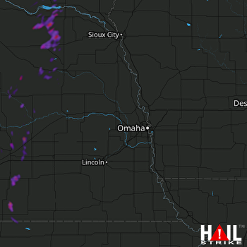 OMAHA (KOAX) RADAR

