This weather event on August 1, 2025 includes:
3 states
35 counties,
12 cities,
and 59 zip codes.
There were 74 total properties that were impacted and have possible damage.
States Impacted By Hail On August 1, 2025
Alabama
·
Florida
·
Georgia
Counties Impacted By Hail On August 1, 2025
Barbour, AL
·
Henry, AL
·
Madison, FL
·
Wakulla, FL
·
Baker, GA
·
Brooks, GA
·
Bryan, GA
·
Bulloch, GA
·
Chatham, GA
·
Clay, GA
·
Cook, GA
·
Dodge, GA
·
Echols, GA
·
Evans, GA
·
Irwin, GA
·
Lanier, GA
·
Lee, GA
·
Liberty, GA
·
Long, GA
·
Lowndes, GA
·
Marion, GA
·
McIntosh, GA
·
Montgomery, GA
·
Randolph, GA
·
Screven, GA
·
Sumter, GA
·
Tattnall, GA
·
Taylor, GA
·
Telfair, GA
·
Terrell, GA
·
Thomas, GA
·
Toombs, GA
·
Webster, GA
·
Wheeler, GA
·
Wilcox, GA
Cities Impacted By Hail On August 1, 2025
Abbeville, AL
·
Echols County, GA
·
Eufaula, AL
·
Fort Gaines, GA
·
Fort Stewart, GA
·
Georgetown, GA
·
Henderson, GA
·
Hinesville, GA
·
Richmond Hill, GA
·
Savannah, GA
·
Valdosta, GA
·
Webster County, GA
Zip Codes Impacted By Hail On August 1, 2025
30411
·
30417
·
30427
·
30461
·
30467
·
30473
·
30474
·
31001
·
31006
·
31011
·
31023
·
31037
·
31077
·
31081
·
31308
·
31309
·
31313
·
31314
·
31315
·
31316
·
31320
·
31321
·
31324
·
31331
·
31409
·
31419
·
31549
·
31601
·
31602
·
31605
·
31606
·
31626
·
31630
·
31632
·
31635
·
31636
·
31641
·
31645
·
31719
·
31721
·
31763
·
31774
·
31780
·
31798
·
31803
·
31832
·
32340
·
32358
·
36027
·
36310
·
36373
·
39824
·
39836
·
39840
·
39842
·
39851
·
39870
·
39877
·
39886
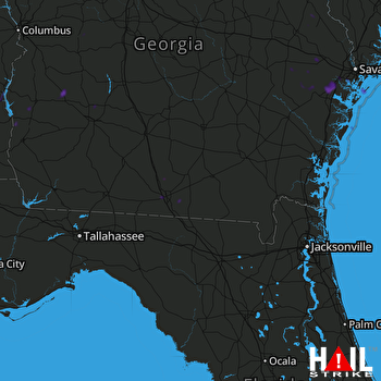 MOODY AFB (KVAX) RADAR

