This weather event on July 31, 2025 includes:
4 states
16 counties,
14 cities,
and 71 zip codes.
There were total properties that were impacted and have possible damage.
States Impacted By Hail On July 31, 2025
Connecticut
·
New Jersey
·
New York
·
Pennsylvania
Counties Impacted By Hail On July 31, 2025
Fairfield, CT
·
Hartford, CT
·
Litchfield, CT
·
Tolland, CT
·
Sussex, NJ
·
Albany, NY
·
Chenango, NY
·
Cortland, NY
·
Dutchess, NY
·
Orange, NY
·
Sullivan, NY
·
Ulster, NY
·
Lackawanna, PA
·
Monroe, PA
·
Pike, PA
·
Wayne, PA
Cities Impacted By Hail On July 31, 2025
Big Bass Lake, PA
·
Clintondale, NY
·
Conashaugh Lakes, PA
·
Emerald Lakes, PA
·
Hemlock Farms, PA
·
Hopewell Junction, NY
·
Merritt Park, NY
·
Plattekill, NY
·
Pocono Mountain Lake Estates, PA
·
Pocono Ranch Lands, PA
·
Pocono Springs, PA
·
Saw Creek, PA
·
Scotchtown, NY
·
Torrington, CT
Zip Codes Impacted By Hail On July 31, 2025
6027
·
6063
·
6065
·
6069
·
6084
·
6091
·
6095
·
6098
·
6754
·
6757
·
6759
·
6784
·
6796
·
6812
·
7826
·
7827
·
7851
·
7881
·
10941
·
12077
·
12158
·
12522
·
12524
·
12528
·
12533
·
12540
·
12542
·
12543
·
12545
·
12547
·
12553
·
12570
·
12575
·
12582
·
12589
·
12592
·
12726
·
12764
·
13040
·
13411
·
13460
·
13803
·
13815
·
13830
·
13843
·
13863
·
18301
·
18302
·
18325
·
18326
·
18328
·
18332
·
18334
·
18337
·
18344
·
18355
·
18357
·
18370
·
18372
·
18405
·
18424
·
18426
·
18428
·
18443
·
18460
·
18466
·
6088
·
6790
·
18324
·
18360
·
18445
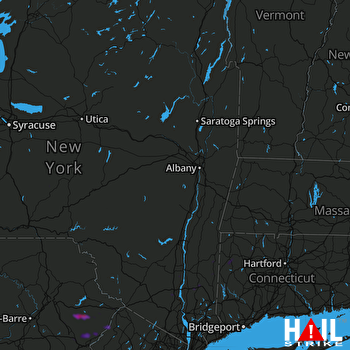 ALBANY (KENX) RADAR

