This weather event on July 30, 2025 includes:
2 states
16 counties,
25 cities,
and 67 zip codes.
There were 1468 total properties that were impacted and have possible damage.
States Impacted By Hail On July 30, 2025
Michigan
·
Ohio
Counties Impacted By Hail On July 30, 2025
Oakland, MI
·
Washtenaw, MI
·
Wayne, MI
·
Allen, OH
·
Ashland, OH
·
Erie, OH
·
Hancock, OH
·
Huron, OH
·
Lorain, OH
·
Ottawa, OH
·
Putnam, OH
·
Richland, OH
·
Sandusky, OH
·
Seneca, OH
·
Van Wert, OH
·
Wyandot, OH
Cities Impacted By Hail On July 30, 2025
Ann Arbor, MI
·
Ballville, OH
·
Bay View, OH
·
Beaverdam, OH
·
Berlin Heights, OH
·
Cairo, OH
·
Carey, OH
·
Eaton Estates, OH
·
Flat Rock, OH
·
Grafton, OH
·
Green Springs, OH
·
Huron, OH
·
Keego Harbor, MI
·
Lake Angelus, MI
·
Mansfield, OH
·
New London, OH
·
North Fairfield, OH
·
Novi, MI
·
Orchard Lake Village, MI
·
Pontiac, MI
·
Saline, MI
·
Sandusky, OH
·
Sylvan Lake, MI
·
Van Wert, OH
·
Ypsilanti, MI
Zip Codes Impacted By Hail On July 30, 2025
43410
·
43420
·
43433
·
43435
·
43440
·
43452
·
44028
·
44044
·
44050
·
44089
·
44811
·
44814
·
44828
·
44836
·
44837
·
44839
·
44846
·
44847
·
44851
·
44855
·
44857
·
44867
·
44870
·
44878
·
44883
·
44890
·
44903
·
45801
·
45804
·
45806
·
45807
·
45808
·
45814
·
45817
·
45820
·
45830
·
45833
·
45840
·
45844
·
45850
·
45867
·
45881
·
45890
·
45891
·
45894
·
48104
·
48105
·
48109
·
48176
·
48178
·
48187
·
48188
·
48189
·
48197
·
48198
·
48320
·
48322
·
48323
·
48324
·
48326
·
48328
·
48341
·
48375
·
48377
·
48390
·
43316
·
44035
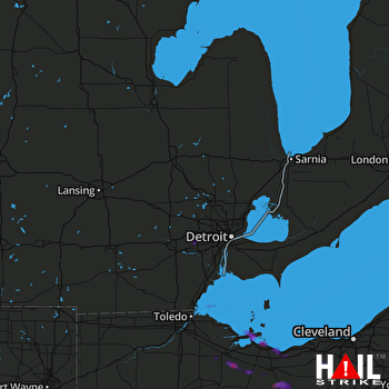 DETROIT (KDTX) RADAR

