This weather event on July 30, 2025 includes:
4 states
18 counties,
20 cities,
and 68 zip codes.
There were total properties that were impacted and have possible damage.
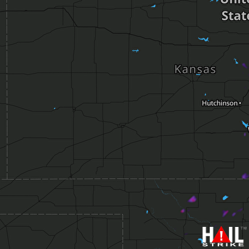 DODGE CITY (KDDC) RADAR
States Impacted By Hail On July 30, 2025
Colorado
·
Kansas
·
Oklahoma
·
Texas
Counties Impacted By Hail On July 30, 2025
Baca, CO
·
Harper, KS
·
Harvey, KS
·
Kingman, KS
·
Marion, KS
·
McPherson, KS
·
Rice, KS
·
Saline, KS
·
Sedgwick, KS
·
Sumner, KS
·
Alfalfa, OK
·
Ellis, OK
·
Garfield, OK
·
Grant, OK
·
Major, OK
·
Woods, OK
·
Woodward, OK
·
Hutchinson, TX
Cities Impacted By Hail On July 30, 2025
Bentley, KS
·
Bluff City, KS
·
Canton, KS
·
Chester, OK
·
Clearwater, KS
·
Goltry, OK
·
Halstead, KS
·
Helena, OK
·
Hesston, KS
·
Lindsborg, KS
·
Maize, KS
·
Marquette, KS
·
Mayfield, KS
·
Moundridge, KS
·
Newton, KS
·
North Newton, KS
·
Park City, KS
·
Valley Center, KS
·
Wellington, KS
·
Wichita, KS
Zip Codes Impacted By Hail On July 30, 2025
67003
·
67004
·
67013
·
67016
·
67018
·
67020
·
67022
·
67025
·
67026
·
67031
·
67050
·
67052
·
67056
·
67062
·
67101
·
67103
·
67105
·
67107
·
67111
·
67114
·
67117
·
67118
·
67120
·
67135
·
67147
·
67149
·
67152
·
67203
·
67204
·
67205
·
67209
·
67212
·
67219
·
67425
·
67428
·
67442
·
67443
·
67448
·
67456
·
67457
·
67460
·
67464
·
67491
·
67546
·
67554
·
67579
·
73703
·
73717
·
73727
·
73737
·
73739
·
73741
·
73753
·
73754
·
73759
·
73760
·
73766
·
73768
·
73771
·
73832
·
73838
·
73852
·
73853
·
73860
·
79081
·
81029
·
81090
·
67060

