This weather event on July 30, 2025 includes:
3 states
18 counties,
19 cities,
and 101 zip codes.
There were 1893 total properties that were impacted and have possible damage.
States Impacted By Hail On July 30, 2025
Maine
·
New Hampshire
·
Vermont
Counties Impacted By Hail On July 30, 2025
Androscoggin, ME
·
Cumberland, ME
·
Franklin, ME
·
Hancock, ME
·
Kennebec, ME
·
Knox, ME
·
Lincoln, ME
·
Oxford, ME
·
Penobscot, ME
·
Piscataquis, ME
·
Somerset, ME
·
Waldo, ME
·
Washington, ME
·
Carroll, NH
·
Coos, NH
·
Grafton, NH
·
Orange, VT
·
Rutland, VT
Cities Impacted By Hail On July 30, 2025
Auburn, ME
·
Augusta, ME
·
Bridgton, ME
·
Casco, ME
·
Clinton, ME
·
Conway, NH
·
Fairlee, VT
·
Fryeburg, ME
·
Lewiston, ME
·
Madison, ME
·
Mechanic Falls, ME
·
Newbury, VT
·
Norridgewock, ME
·
North Conway, NH
·
North Haverhill, NH
·
Portland, ME
·
Skowhegan, ME
·
South Portland, ME
·
Winthrop, ME
Zip Codes Impacted By Hail On July 30, 2025
3251
·
3279
·
3574
·
3575
·
3580
·
3581
·
3585
·
3593
·
3768
·
3774
·
3777
·
3780
·
3785
·
3812
·
3818
·
3846
·
3860
·
4009
·
4015
·
4022
·
4037
·
4040
·
4069
·
4071
·
4106
·
4107
·
4210
·
4217
·
4222
·
4231
·
4238
·
4240
·
4256
·
4258
·
4259
·
4260
·
4263
·
4265
·
4270
·
4274
·
4280
·
4282
·
4284
·
4330
·
4345
·
4348
·
4350
·
4351
·
4352
·
4354
·
4355
·
4358
·
4363
·
4364
·
4414
·
4415
·
4464
·
4574
·
4654
·
4686
·
4911
·
4917
·
4920
·
4921
·
4922
·
4925
·
4932
·
4938
·
4950
·
4956
·
4957
·
4961
·
4967
·
4985
·
4986
·
4987
·
4989
·
5036
·
5038
·
5045
·
5051
·
5058
·
5060
·
5061
·
5069
·
5070
·
5072
·
5075
·
5076
·
5077
·
5079
·
5081
·
5083
·
5086
·
5739
·
5773
·
4976
·
4927
·
4236
·
4039
·
3813
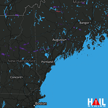 PORTLAND (KGYX) RADAR

