This weather event on July 29, 2025 includes:
3 states
26 counties,
21 cities,
and 73 zip codes.
There were 881 total properties that were impacted and have possible damage.
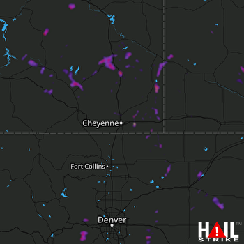 CHEYENNE (KCYS) RADAR
States Impacted By Hail On July 29, 2025
Colorado
·
Nebraska
·
Wyoming
Counties Impacted By Hail On July 29, 2025
Adams, CO
·
Arapahoe, CO
·
Clear Creek, CO
·
Elbert, CO
·
Gilpin, CO
·
Larimer, CO
·
Logan, CO
·
Morgan, CO
·
Park, CO
·
Washington, CO
·
Weld, CO
·
Banner, NE
·
Box Butte, NE
·
Dawes, NE
·
Garden, NE
·
Kimball, NE
·
Morrill, NE
·
Scotts Bluff, NE
·
Sioux, NE
·
Albany, WY
·
Carbon, WY
·
Converse, WY
·
Goshen, WY
·
Laramie, WY
·
Natrona, WY
·
Platte, WY
Cities Impacted By Hail On July 29, 2025
Arlington, WY
·
Black Hawk, CO
·
Carpenter, WY
·
Central City, CO
·
Chugcreek, WY
·
Chugwater, WY
·
Comanche Creek, CO
·
Gering, NE
·
Harrisburg, NE
·
Huntley, WY
·
La Grange, WY
·
Lakeview North, WY
·
Lyman, NE
·
Medicine Bow, WY
·
Ranchettes, WY
·
Slater, WY
·
Strasburg, CO
·
Westview Circle, WY
·
Wheatland, WY
·
Whiting, WY
·
Y-O Ranch, WY
Zip Codes Impacted By Hail On July 29, 2025
69125
·
69133
·
69145
·
69301
·
69341
·
69345
·
69348
·
69351
·
69352
·
69354
·
69357
·
69358
·
80103
·
80105
·
80106
·
80117
·
80136
·
80403
·
80421
·
80422
·
80427
·
80439
·
80452
·
80512
·
80521
·
80611
·
80649
·
80652
·
80653
·
80654
·
80701
·
80720
·
80723
·
80729
·
80733
·
80740
·
80741
·
80742
·
80743
·
80750
·
80757
·
80808
·
82007
·
82009
·
82050
·
82051
·
82053
·
82054
·
82060
·
82061
·
82072
·
82081
·
82082
·
82083
·
82201
·
82212
·
82213
·
82214
·
82217
·
82221
·
82223
·
82240
·
82243
·
82244
·
82324
·
82327
·
82329
·
82633
·
82637
·
82210
·
82058
·
80102
·
69148

