This weather event on July 29, 2025 includes:
4 states
29 counties,
13 cities,
and 59 zip codes.
There were 2098 total properties that were impacted and have possible damage.
States Impacted By Hail On July 29, 2025
Alabama
·
Florida
·
Louisiana
·
Mississippi
Counties Impacted By Hail On July 29, 2025
Baldwin, AL
·
Clarke, AL
·
Coffee, AL
·
Conecuh, AL
·
Covington, AL
·
Crenshaw, AL
·
Dallas, AL
·
Escambia, AL
·
Mobile, AL
·
Monroe, AL
·
Perry, AL
·
Washington, AL
·
Escambia, FL
·
Santa Rosa, FL
·
Walton, FL
·
Livingston, LA
·
Orleans, LA
·
St. Bernard, LA
·
St. John the Baptist, LA
·
St. Tammany, LA
·
Tangipahoa, LA
·
Washington, LA
·
Forrest, MS
·
Hancock, MS
·
Harrison, MS
·
Jefferson Davis, MS
·
Lawrence, MS
·
Pearl River, MS
·
Stone, MS
Cities Impacted By Hail On July 29, 2025
Bay Minette, AL
·
Biloxi, MS
·
Dauphin Island, AL
·
Gulfport, MS
·
Luverne, AL
·
Mobile, AL
·
Munson, FL
·
New Orleans, LA
·
Silver Creek, MS
·
Spanish Fort, AL
·
Theodore, AL
·
Tillmans Corner, AL
·
Wiggins, MS
Zip Codes Impacted By Hail On July 29, 2025
32507
·
32531
·
32570
·
36035
·
36049
·
36323
·
36351
·
36401
·
36421
·
36432
·
36436
·
36444
·
36445
·
36460
·
36470
·
36480
·
36482
·
36502
·
36507
·
36523
·
36527
·
36528
·
36544
·
36545
·
36550
·
36553
·
36582
·
36605
·
36615
·
36619
·
36695
·
36701
·
36756
·
36759
·
36784
·
36786
·
39426
·
39455
·
39466
·
39470
·
39503
·
39507
·
39520
·
39531
·
39532
·
39561
·
39573
·
39574
·
39577
·
39654
·
39656
·
70129
·
70422
·
70426
·
70438
·
70444
·
70454
·
70462
·
39663
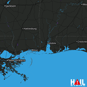 MOBILE (KMOB) RADAR

