This weather event on July 29, 2025 includes:
4 states
35 counties,
11 cities,
and 65 zip codes.
There were 92 total properties that were impacted and have possible damage.
States Impacted By Hail On July 29, 2025
Arkansas
·
Louisiana
·
Missouri
·
Mississippi
Counties Impacted By Hail On July 29, 2025
Ashley, AR
·
Calhoun, AR
·
Chicot, AR
·
Clay, AR
·
Cleveland, AR
·
Columbia, AR
·
Crawford, AR
·
Dallas, AR
·
Drew, AR
·
Faulkner, AR
·
Garland, AR
·
Grant, AR
·
Hot Spring, AR
·
Nevada, AR
·
Ouachita, AR
·
Perry, AR
·
Pike, AR
·
Randolph, AR
·
Scott, AR
·
Sevier, AR
·
Union, AR
·
Claiborne, LA
·
Morehouse, LA
·
Union, LA
·
Barry, MO
·
Stone, MO
·
Bolivar, MS
·
Coahoma, MS
·
DeSoto, MS
·
Issaquena, MS
·
Leflore, MS
·
Panola, MS
·
Quitman, MS
·
Tallahatchie, MS
·
Washington, MS
Cities Impacted By Hail On July 29, 2025
Alma, AR
·
Fordyce, AR
·
Greenville, MS
·
Harrell, AR
·
Huttig, AR
·
Lonsdale, AR
·
Marks, MS
·
Murfreesboro, AR
·
Prescott, AR
·
Rudy, AR
·
Shell Knob, MO
Zip Codes Impacted By Hail On July 29, 2025
38619
·
38632
·
38643
·
38645
·
38646
·
38666
·
38701
·
38703
·
38731
·
38744
·
38748
·
38760
·
38773
·
38920
·
38928
·
38944
·
38950
·
65656
·
65658
·
65747
·
71038
·
71220
·
71223
·
71241
·
71260
·
71261
·
71280
·
71642
·
71652
·
71653
·
71675
·
71730
·
71740
·
71742
·
71744
·
71745
·
71749
·
71752
·
71762
·
71764
·
71765
·
71770
·
71832
·
71841
·
71846
·
71852
·
71857
·
71901
·
71909
·
71958
·
72039
·
72087
·
72104
·
72126
·
72128
·
72444
·
72470
·
72921
·
72926
·
72946
·
72950
·
72952
·
71833
·
71747
·
38617
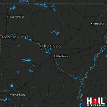 LITTLE ROCK (KLZK) RADAR

