This weather event on July 29, 2025 includes:
2 states
20 counties,
15 cities,
and 56 zip codes.
There were total properties that were impacted and have possible damage.
States Impacted By Hail On July 29, 2025
Arkansas
·
Louisiana
Counties Impacted By Hail On July 29, 2025
Ashley, AR
·
Columbia, AR
·
Union, AR
·
Ascension, LA
·
Assumption, LA
·
Catahoula, LA
·
Claiborne, LA
·
Concordia, LA
·
East Carroll, LA
·
Franklin, LA
·
Iberville, LA
·
Lincoln, LA
·
Livingston, LA
·
Madison, LA
·
Morehouse, LA
·
Ouachita, LA
·
Richland, LA
·
Tensas, LA
·
Union, LA
·
West Carroll, LA
Cities Impacted By Hail On July 29, 2025
Bastrop, LA
·
Bawcomville, LA
·
Brownsville, LA
·
Calhoun, LA
·
Claiborne, LA
·
Downsville, LA
·
Epps, LA
·
Lakeshore, LA
·
Lisbon, LA
·
Monroe, LA
·
Richwood, LA
·
Simsboro, LA
·
Start, LA
·
St. Gabriel, LA
·
West Monroe, LA
Zip Codes Impacted By Hail On July 29, 2025
70339
·
70346
·
70390
·
70706
·
70721
·
70725
·
70726
·
70737
·
70776
·
70788
·
71001
·
71040
·
71201
·
71202
·
71209
·
71219
·
71220
·
71222
·
71223
·
71225
·
71227
·
71229
·
71232
·
71234
·
71235
·
71237
·
71241
·
71254
·
71259
·
71260
·
71261
·
71264
·
71266
·
71269
·
71275
·
71276
·
71277
·
71279
·
71280
·
71282
·
71286
·
71291
·
71292
·
71295
·
71326
·
71334
·
71368
·
71375
·
71635
·
71740
·
71749
·
71753
·
70734
·
71203
·
71747
·
71765
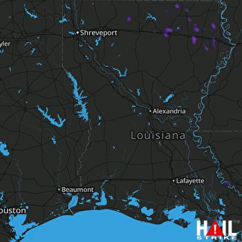 FORT POLK (KPOE) RADAR

