This weather event on July 29, 2025 includes:
2 states
12 counties,
28 cities,
and 43 zip codes.
There were total properties that were impacted and have possible damage.
States Impacted By Hail On July 29, 2025
Iowa
·
Minnesota
Counties Impacted By Hail On July 29, 2025
Clay, IA
·
Dickinson, IA
·
Emmet, IA
·
Humboldt, IA
·
Kossuth, IA
·
Osceola, IA
·
Palo Alto, IA
·
Pocahontas, IA
·
Wright, IA
·
Cottonwood, MN
·
Jackson, MN
·
Nobles, MN
Cities Impacted By Hail On July 29, 2025
Arnolds Park, IA
·
Ayrshire, IA
·
Bigelow, MN
·
Bode, IA
·
Cylinder, IA
·
Dickens, IA
·
Emmetsburg, IA
·
Estherville, IA
·
Hardy, IA
·
Lake Park, IA
·
Livermore, IA
·
Mallard, IA
·
Milford, IA
·
Okoboji, IA
·
Orleans, IA
·
Ottosen, IA
·
Rodman, IA
·
Round Lake, MN
·
Ruthven, IA
·
Spencer, IA
·
Spirit Lake, IA
·
St. Joseph, IA
·
Superior, IA
·
Wahpeton, IA
·
Wallingford, IA
·
West Bend, IA
·
West Okoboji, IA
·
Worthington, MN
Zip Codes Impacted By Hail On July 29, 2025
50515
·
50519
·
50527
·
50528
·
50536
·
50542
·
50545
·
50546
·
50548
·
50558
·
50570
·
50577
·
50581
·
50582
·
50597
·
50598
·
51249
·
51331
·
51333
·
51334
·
51338
·
51342
·
51343
·
51345
·
51347
·
51351
·
51354
·
51355
·
51358
·
51360
·
51363
·
51364
·
51365
·
51366
·
56117
·
56150
·
56152
·
56165
·
56167
·
56168
·
56187
·
50562
·
51301
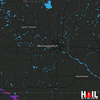 MINNEAPOLIS (KMPX) RADAR

