This weather event on July 29, 2025 includes:
2 states
15 counties,
43 cities,
and 74 zip codes.
There were total properties that were impacted and have possible damage.
States Impacted By Hail On July 29, 2025
Iowa
·
South Dakota
Counties Impacted By Hail On July 29, 2025
Buena Vista, IA
·
Cherokee, IA
·
Clay, IA
·
Hamilton, IA
·
Humboldt, IA
·
Lyon, IA
·
O'Brien, IA
·
Osceola, IA
·
Palo Alto, IA
·
Plymouth, IA
·
Pocahontas, IA
·
Sioux, IA
·
Webster, IA
·
Lincoln, SD
·
Turner, SD
Cities Impacted By Hail On July 29, 2025
Albert City, IA
·
Alton, IA
·
Alvord, IA
·
Ashton, IA
·
Ayrshire, IA
·
Boyden, IA
·
Calumet, IA
·
Canton, SD
·
Clare, IA
·
Coalville, IA
·
Craig, IA
·
Davis, SD
·
Doon, IA
·
Fairview, SD
·
George, IA
·
Gillett Grove, IA
·
Granville, IA
·
Greenville, IA
·
Havelock, IA
·
Hull, IA
·
Inwood, IA
·
Laurens, IA
·
Lehigh, IA
·
Le Mars, IA
·
Mallard, IA
·
Marathon, IA
·
Maurice, IA
·
Orange City, IA
·
Otho, IA
·
Palmer, IA
·
Paullina, IA
·
Peterson, IA
·
Pioneer, IA
·
Pocahontas, IA
·
Primghar, IA
·
Rock Rapids, IA
·
Rock Valley, IA
·
Rossie, IA
·
Royal, IA
·
Sanborn, IA
·
Sheldon, IA
·
Spencer, IA
·
Webb, IA
Zip Codes Impacted By Hail On July 29, 2025
50249
·
50501
·
50510
·
50515
·
50518
·
50524
·
50527
·
50532
·
50536
·
50540
·
50541
·
50546
·
50548
·
50554
·
50557
·
50562
·
50563
·
50565
·
50569
·
50571
·
50574
·
50575
·
50581
·
50585
·
51001
·
51003
·
51009
·
51012
·
51014
·
51022
·
51023
·
51029
·
51031
·
51033
·
51036
·
51037
·
51041
·
51046
·
51047
·
51050
·
51201
·
51230
·
51231
·
51232
·
51234
·
51235
·
51237
·
51238
·
51239
·
51240
·
51243
·
51245
·
51246
·
51247
·
51248
·
51301
·
51333
·
51338
·
51341
·
51343
·
51346
·
51357
·
51358
·
51366
·
57004
·
57013
·
57021
·
57027
·
57036
·
57039
·
57077
·
51058
·
51027
·
50595
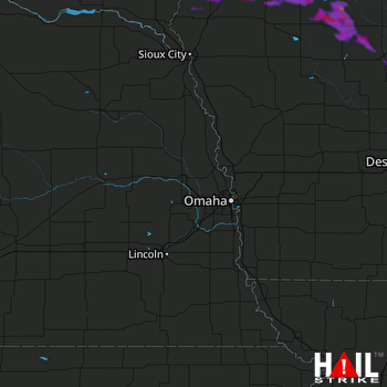 OMAHA (KOAX) RADAR

