This weather event on July 28, 2025 includes:
3 states
24 counties,
16 cities,
and 61 zip codes.
There were 2220 total properties that were impacted and have possible damage.
States Impacted By Hail On July 28, 2025
Georgia
·
North Carolina
·
South Carolina
Counties Impacted By Hail On July 28, 2025
Bryan, GA
·
Chatham, GA
·
Effingham, GA
·
Greene, GA
·
Liberty, GA
·
Morgan, GA
·
Oglethorpe, GA
·
Columbus, NC
·
Cumberland, NC
·
Beaufort, SC
·
Berkeley, SC
·
Calhoun, SC
·
Charleston, SC
·
Chesterfield, SC
·
Colleton, SC
·
Darlington, SC
·
Dorchester, SC
·
Fairfield, SC
·
Jasper, SC
·
Kershaw, SC
·
Lexington, SC
·
Orangeburg, SC
·
Richland, SC
·
Sumter, SC
Cities Impacted By Hail On July 28, 2025
Bloomingdale, GA
·
Cayce, SC
·
Elgin, SC
·
Gaston, SC
·
Hardeeville, SC
·
Hope Mills, NC
·
Laurel Bay, SC
·
Pooler, GA
·
Port Wentworth, GA
·
Red Bank, SC
·
Ridgeland, SC
·
Rincon, GA
·
Savannah, GA
·
Society Hill, SC
·
West Columbia, SC
·
Winnsboro Mills, SC
Zip Codes Impacted By Hail On July 28, 2025
28306
·
28348
·
28371
·
28432
·
28455
·
29030
·
29033
·
29044
·
29045
·
29053
·
29059
·
29061
·
29073
·
29078
·
29112
·
29125
·
29135
·
29154
·
29160
·
29169
·
29172
·
29180
·
29201
·
29203
·
29205
·
29207
·
29209
·
29212
·
29426
·
29436
·
29437
·
29446
·
29448
·
29470
·
29472
·
29485
·
29593
·
29906
·
29922
·
29927
·
29936
·
29940
·
29943
·
30642
·
30650
·
30660
·
30663
·
30667
·
30669
·
31302
·
31303
·
31308
·
31312
·
31322
·
31326
·
31329
·
31407
·
31408
·
31419
·
29168
·
29063
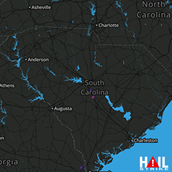 COLUMBIA (KCAE) RADAR

