This weather event on July 26, 2025 includes:
5 states
28 counties,
12 cities,
and 68 zip codes.
There were 1320 total properties that were impacted and have possible damage.
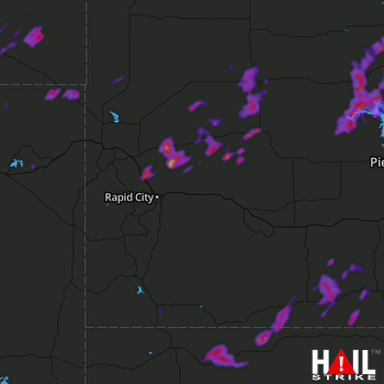 RAPID CITY (KUDX) RADAR
States Impacted By Hail On July 26, 2025
Montana
·
North Dakota
·
Nebraska
·
South Dakota
·
Wyoming
Counties Impacted By Hail On July 26, 2025
Carter, MT
·
Powder River, MT
·
Adams, ND
·
Bowman, ND
·
Box Butte, NE
·
Cherry, NE
·
Dawes, NE
·
Sheridan, NE
·
Bennett, SD
·
Butte, SD
·
Corson, SD
·
Dewey, SD
·
Fall River, SD
·
Haakon, SD
·
Harding, SD
·
Jackson, SD
·
Lawrence, SD
·
Meade, SD
·
Mellette, SD
·
Oglala Lakota, SD
·
Pennington, SD
·
Perkins, SD
·
Potter, SD
·
Stanley, SD
·
Sully, SD
·
Todd, SD
·
Ziebach, SD
·
Crook, WY
Cities Impacted By Hail On July 26, 2025
Alliance, NE
·
Clinton, NE
·
Corn Creek, SD
·
Hemingford, NE
·
La Plant, SD
·
Martin, SD
·
Rosebud, SD
·
Rushville, NE
·
Scranton, ND
·
Soldier Creek, SD
·
Spring Creek, SD
·
Two Strike, SD
Zip Codes Impacted By Hail On July 26, 2025
57501
·
57521
·
57532
·
57537
·
57547
·
57551
·
57552
·
57555
·
57564
·
57566
·
57570
·
57572
·
57574
·
57579
·
57601
·
57625
·
57626
·
57649
·
57651
·
57652
·
57656
·
57657
·
57661
·
57714
·
57716
·
57717
·
57718
·
57719
·
57720
·
57732
·
57748
·
57752
·
57755
·
57758
·
57759
·
57761
·
57763
·
57769
·
57785
·
57787
·
57788
·
57790
·
57791
·
57792
·
58623
·
58649
·
58651
·
58653
·
59311
·
59317
·
59324
·
69216
·
69218
·
69301
·
69337
·
69343
·
69347
·
69348
·
69351
·
69360
·
82721
·
82730
·
57442
·
57520
·
57560
·
57623
·
59332
·
82720

