This weather event on July 25, 2025 includes:
2 states
35 counties,
19 cities,
and 59 zip codes.
There were total properties that were impacted and have possible damage.
States Impacted By Hail On July 25, 2025
Florida
·
Georgia
Counties Impacted By Hail On July 25, 2025
Columbia, FL
·
Hamilton, FL
·
Okaloosa, FL
·
Suwannee, FL
·
Walton, FL
·
Appling, GA
·
Atkinson, GA
·
Bacon, GA
·
Ben Hill, GA
·
Berrien, GA
·
Brantley, GA
·
Charlton, GA
·
Chattahoochee, GA
·
Clinch, GA
·
Coffee, GA
·
Crisp, GA
·
Dodge, GA
·
Dooly, GA
·
Echols, GA
·
Houston, GA
·
Irwin, GA
·
Jeff Davis, GA
·
Lanier, GA
·
Lowndes, GA
·
Pierce, GA
·
Pulaski, GA
·
Stewart, GA
·
Sumter, GA
·
Telfair, GA
·
Tift, GA
·
Turner, GA
·
Ware, GA
·
Webster, GA
·
Wilcox, GA
·
Worth, GA
Cities Impacted By Hail On July 25, 2025
Alma, GA
·
Blackshear, GA
·
Broxton, GA
·
Cordele, GA
·
Cusseta-Chattahoochee County, GA
·
Denton, GA
·
De Soto, GA
·
Douglas, GA
·
Echols County, GA
·
Fitzgerald, GA
·
Hoboken, GA
·
Leslie, GA
·
Nashville, GA
·
Ocilla, GA
·
Patterson, GA
·
Rhine, GA
·
Satilla, GA
·
Ty Ty, GA
·
Webster County, GA
Zip Codes Impacted By Hail On July 25, 2025
31001
·
31015
·
31023
·
31025
·
31055
·
31060
·
31071
·
31077
·
31091
·
31092
·
31503
·
31510
·
31512
·
31513
·
31516
·
31519
·
31532
·
31533
·
31535
·
31539
·
31542
·
31549
·
31551
·
31553
·
31554
·
31557
·
31567
·
31631
·
31635
·
31636
·
31639
·
31648
·
31650
·
31709
·
31743
·
31750
·
31764
·
31774
·
31790
·
31793
·
31794
·
31795
·
31798
·
31805
·
31814
·
31824
·
31825
·
32052
·
32055
·
32060
·
32455
·
32544
·
32547
·
32548
·
32569
·
32053
·
31642
·
31641
·
31036
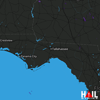 TALLAHASSEE (KTLH) RADAR

