This weather event on July 24, 2025 includes:
2 states
20 counties,
19 cities,
and 55 zip codes.
There were total properties that were impacted and have possible damage.
States Impacted By Hail On July 24, 2025
Illinois
·
Missouri
Counties Impacted By Hail On July 24, 2025
Adams, IL
·
Brown, IL
·
Cass, IL
·
Fulton, IL
·
Hancock, IL
·
Mason, IL
·
McDonough, IL
·
Morgan, IL
·
Peoria, IL
·
Pike, IL
·
Schuyler, IL
·
Scott, IL
·
Tazewell, IL
·
Warren, IL
·
Clark, MO
·
Lewis, MO
·
Marion, MO
·
Pike, MO
·
Ralls, MO
·
Shelby, MO
Cities Impacted By Hail On July 24, 2025
Adair, IL
·
Barry, IL
·
Bartonville, IL
·
Bluffs, IL
·
Creve Coeur, IL
·
East Peoria, IL
·
Exeter, IL
·
Griggsville, IL
·
Hannibal, MO
·
Kingston Mines, IL
·
Mapleton, IL
·
Marquette Heights, IL
·
Mound Station, IL
·
Mount Sterling, IL
·
New Canton, IL
·
North Pekin, IL
·
Pekin, IL
·
Perry, IL
·
Quincy, IL
Zip Codes Impacted By Hail On July 24, 2025
61411
·
61417
·
61440
·
61455
·
61459
·
61477
·
61482
·
61484
·
61501
·
61539
·
61546
·
61547
·
61554
·
61568
·
61607
·
61611
·
62301
·
62305
·
62312
·
62314
·
62323
·
62324
·
62338
·
62340
·
62343
·
62345
·
62347
·
62353
·
62356
·
62362
·
62365
·
62375
·
62378
·
62379
·
62617
·
62618
·
62621
·
62624
·
62628
·
62639
·
62644
·
62650
·
62665
·
62681
·
62694
·
63401
·
63433
·
63435
·
63439
·
63443
·
63456
·
63461
·
63467
·
61610
·
63459
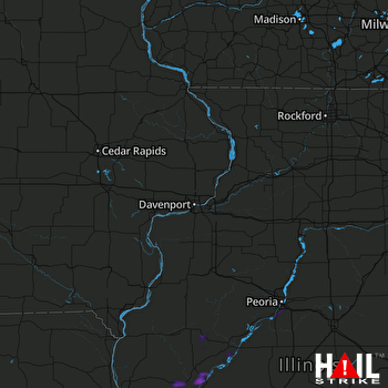 DAVENPORT (KDVN) RADAR

